At 38 years old, I was forty pounds overweight, prehypertensive, and feeling lost in many aspects of my life. Changes needed to be made. I started walking every morning as a New Years resolution which led to jogging, then running, then running and cycling, and then running, cycling, and swimming. I had become a triathlete. This is a blog about my triathlon journey, becoming disciplined and finding the freedom that comes with it.
Backpacking friends and family always talk about West Virginia with fondness. I was anxious to find a trek that was convenient for a weekend trip and yet far away enough that it felt like an adventure. My dad loaned me his signed copy of Michael V. Juskelis's book, "The Mid-Atlantic Hiker's Guide: West Virginia." Dad was a frequent hiker with Mr. Juskelis so I knew it was a reliable source. I began planning this hike in August when I became the new outdoor activity coordinator for my son Andrew's scout troop. I was immediately attracted to the options described in George Washington-Jefferson National Forest in the Lee Ranger District due to its proximity to where we live. Within a 3 hour drive from north of Baltimore, it offered rugged, rocky, and steep terrain with multiple rivers, streams, mountains, lookouts, and camping options. I zeroed in on the Pond Run-Racer Camp Hollow Trail loop that includes portions of the Tuscarora Trail. The Tuscarora Trail stretches for 250 miles through Pennsylvania, Maryland, Virginia, and West Virginia. Below is a map of our initial plan.
Our trip began immediately after Andrew arrived home from school on Friday. Andrew, my nephew Luke, Andrew's friend Keegan, his dad Mike and I linked up and departed at 3:30 PM. We knew traffic would be heavy and anticipated it would take a little over 3 hours to get to the trail head. Also due to the time of year, we knew we would be hiking in the dark. As expected, the traffic on the Baltimore Beltway was slow until we reached I-70. In Frederick, I-70 slowed but we soon turned off onto 340 S towards Harpers Ferry and found a steady flow of traffic. We stopped for dinner at Sheetz in Charlestown just before reaching I-81 to head south towards Winchester, VA. The Sheetz was adjacent to the Charlestown Race Track and we saw all kinds of race track culture walking in and out of the store. We were treated the rest of the way to some very animated banter by Andrew after he had finished a caffeinated beverage.
Eventually, we made it to Wardensville, WV and wiggled our way through the back roads and eventually the cinder roads of the National Forest. The book was very precise about the trailhead being adjacent to a one-lane bridge and we knew exactly when we had arrived in the correct location. We disembarked and were immediately surprised by the sound of Pond Run. The recent rains clearly had swelled this watershed and we were in for something special. We laced up our hiking shoes and made our last preparations before taking a quick group selfie in the dark and headed out on our journey at 7:40 PM (sorry my iPhone flash was not powerful enough to reach Mike and Keegan).
The blue-blazed Pond Run / Tuscarora Trail started on the south side of Route 5/1 Waites Run Road and on the North side of the one-lane bridge. All three boys were working on their backpacking merit badge for scouts, of which I am a counselor. Since this portion of trail was a relatively straight shot, I had each of them measure the bearing on their compasses from the trail head to our destination. I continued having them check the bearing as we went to be sure we were trending in the correct direction. After a short down hill section to reach the river bed, we hiked along the run for the majority of this segment. The trail makes an abrupt change in incline to climb approximately 1200' to the campsite.
The guide book indicated the trail crosses over Pond Run "several times." Due to the heavy rains that passed through the area on Thursday night into Friday, the Run was swelled. We were forced to improvise our way across as the typical path was not always obvious. Ultimately we crossed Pond Run seven times and this served as an opening salvo on our journey to realize we were traversing some technical terrain. I attempted some video of this effort but unfortunately it was simply too dark and our headlamps did not provide adequate lighting. Ultimately, none of us escaped with completely dry feet and we wondered what we had gotten into.
We arrived at the campsite which was at the intersection of Tuscarora Trail and Halfmoon Trail just before 9 PM. This 2.4 mile section took us under two hours and we were happy to set up camp and call it a night. The campsite had plenty of room, many flat soft areas for pitching a tent, and a fire pit with log seating. We elected to eat a snack before bed and quickly retired for the evening. Andrew and Luke had their single man tents, Mike and Keegan shared a nice REI two-man tent, and I used a new Outdoor Research Helium Bivy Sack that I have been itching to test. The wind was fairly stiff so the ~45 degree temperatures felt more like it was in the low 30s. It was nice to slip into our warm sleeping bags for the night.
Morning arrived slowly due to the high winds; it was a noisy night. At sunrise around 6:40 AM, our camp began to rise. Andrew and Luke are always good about packing up their gear before making breakfast. This morning was no exception. We had strung up our food bags on a nearby tree in which Luke helped me lower down. None of us had to refill water as we had packed enough fresh water and went to work preparing our meals. Finally in the daylight, we could get a good look at our surroundings. We had clearly missed the peak Fall foliage and could see through the trees in 360 degrees. To our East was Mill Mountain with a peak 3,173' which we would navigate around later in the day. To our West was Halfmoon Mountain which includes a look-out at an elevation of 2,826'. That was our first destination for the day.
Just before 9 AM, we finished packing and hiked to the West-Northwest along the Halfmoon Trail. We planned an out-and-back section so we could witness the views from the lookout before embarking on our main trek of the day. From our campsite, the trail dipped down into a small valley before climbing back up to the lookout. Along the way, the boys practiced "staying found" by following along a map I provided to them. We practiced looking at landmarks and also interpreting the real terrain with what they saw on the map. It was fun seeing the light-bulbs go off in their heads as they were able to see their surroundings and relate the view around them with the paper in their hand. We also encountered our first backpackers coming from the lookout.
It took us about 50 minutes to hike the 1.3 miles and climb about 220'. We had completely shook off any chill that might have been in our bones from the wind. The stunning views of Trout Run Valley did not disappoint and we were greeted with waves of light snow flurries! Looking to our left and running south was North Mountain. Looking to our right running almost in parallel was Long Mountain. The wind was raw and strong but we still elected to sit down and have a quick snack before heading back the way we came. Being predominantly downhill, we were back at our starting point in half the time it took us to reach the lookout.
Just past our campsite, heading Southeast along Tuscarora Trail, we came to a boardwalk where we found a nice spring head and stream. Each of us took time to fill-up and prepare for our late morning stroll to Sugar Knob. Each of us had different strategies for water on this trip. Andrew had two 32 oz Nalgene bottles. One bottle had a built-inEpic Water Filterthat essentially operates like a straw within the bottle while filtering the water. Luke had two 32 oz. Nalgene bottles and he used my MSR TrailShot Water Filter. This was our first time using this one and it was really light, compact, and very easy to operation (see video below). Andrew also used this to fill his Nalgene bottles. Mike and Keegan utilized water bottles that they filled with the TrailShot as well. Unfortunately, Mike's filters on his HydraPak Katadyn bottles appeared to have "froze" up so they just refilled their bottles with the TrailShot. I carried two 500-ml Salomon soft flasks with XA Filter Caps. In hindsight, I wish I had brought one more to have some spare water for cooking or for our longer sections that lacked water.
We continued South along the Tuscarora Trail for about a half mile to a junction. We could continue along the Tuscarora Trail, however the route in the book took us along a 0.6 mile winding path on the Mill Mountain Trail. This contour trail led us to the ridge line along Mill Mountain and offered us a view to the North of the valley below and to the East of Sugar Knob. We skirted just under the peak of Mill Mountain and back to Tuscarora Trail and continued on a Southeasterly direction. The Tuscarora Trail at this point had become an accessible forest road which was clearly rutted by vehicles and we encountered several mountain bikers. After about a half mile, we reached the Sugar Knob campsites and continued down the Little Stony Run Trail to a cabin. You can reserve the cabin through the Potomac Appalachian Trail Club and unfortunately it was occupied when we arrived. Therefore, we elected to double back and eat along the Tuscarora Trail at a nearby campsite.
After eating some delicious meals, we refilled our water supply and headed back down Little Stony Run Trail to a nice spring head that was pouring abundant amounts of clear water. We all topped off and strapped our packs down for our afternoon jaunt. From Sugar Knob, we descended 400' down to the Racer Camp Hollow Valley below. It was at this point we had the boys make a decision. I had provided a plan and map to hike Northeast from this point along Racer Camp Hollow along the stream. We would be at a lower elevation but potentially have to cross the stream several times. Being that we were unfamiliar with the terrain and our fresh experience from the night before, crossing the stream with freezing temperatures over night was a bit daunting. I offered an alternative route to continue along the Tuscarora Trail to climb Little Sluice Mountain to camp at White Rocks. One concern we had was regarding the water options for the evening. We encountered a group of back packers coming down from Little Sluice Mountain and I asked if there was any water source at White Rocks. They indicated one was available about a half mile past the campsite. After much deliberation, the boys elected to go with the climb. Mike and Keegan refilled their water supply at a nearby spring head and away we went.
The Tuscarora Trail continued to be a fairly tame forest road heading East-Northeast and calmly traversed the contours. There were only a couple areas of steep trail to reach the ridge line of Little Sluice Mountain. All told, we reached the highest elevation of the trip at about 3,010' and traveled about a mile along the ridgeline before reaching the white-blazed White Rocks Trail. The mountain top was shaped in a saddle and it was not abundantly apparent that we were going to reach anything spectacular. We reached a campsite and we were all a bit disappointed to see several back packs laying on the ground. We looked around for another area to camp and fortunately found some areas that worked for us. Mike, Keegan, Andrew, and Luke's tents would be on some awkward pitches and my bivy was set up on a side trail that led to nowhere. In the middle was a nice fire pit in which the boys were chomping at the bit to get going in starting a fire.
I immediately became restless that "White Rocks" might have been a let down as I was expecting to be at the peak of the mountain with terrific views towards the west for the setting sun. I started to explore around the site and found that there were some cliffs nearby but seemed to be blocked by a fair amount of trees. However, after a few minutes of working my way around, I looked through the trees and saw a large white rock outcropping and knew that we were in the right place! As I approached the base of the White Rocks, I scrambled up about 25' to the outcropping of rock and walked out to the cliff's edge and was presented with a marvelous view that extended nearly 180 degrees looking into Virginia from varying points along the rock line. Starting with Capola Mountain to the East, then Tea Mountain beyond that, and then both were swallowed up by Little North Mountain beyond them. I returned to the campsite to report what I found and collected the group so we could go back and enjoy the view of the setting sun before dinner.
As darkness fell, we busied ourselves with collecting wood for a fire and made our dinner. The boys enjoyed their time building the fire despite the winds. They had diminished a fair amount but sudden gusts were still prevalent. While fixing dinner, a wind gust sent the fire outside the ring and started to consume Andrew's gloves that were drying a bit too close. They were our only casualty of the outing.
This was going to be our coldest night on the trail with predicted temperatures in the low 30s. At around 7 PM, everyone seemed tired and we each made our way back to our sleeping quarters to end the night. Sleep was still fairly difficult to come for all of us as the cold was indeed setting in. Additionally, the slope of the tents were not helping. It was a long night for all!
As soon as it was light, our site stirred and wasted no time in packing and preparing breakfast. We were anxious to get going and warm up! I rose fairly quickly as I wanted to see if I could get some pictures of the sunrise before getting everything organized. Boy was I happy I did that!
It definitely fell below freezing as some of the water remaining in our bottles was frozen and it took longer to boil than usual. Toes and noses were numb and the warm meal, coffee, and hot chocolate helped to resurrect our bodies. We were packed and back on the trail before 8:30 AM. We had to double back up the White Rocks Trail and back to Tuscarora Trail. As expected based on the reports by the backpackers we saw the afternoon before, there was a spring head about a quarter mile down the trail. I was the only one out of water and filled a single flask quickly and continued on. We continued to descend and reached the start of Old Mailpath and turned left. This was the end of our journey on the Tuscarora Trail.
Old Mailpath continued to descend all the way down past Racer Camp Hollow Trail and down to Waites Run. We finally reached Waites Run Road that ran along Wilson Cove and led us back to our parked vehicle. Even though we were on a road, the views were no less spectacular along the rushing river. There was a beautiful lake called Wilson Cove at the base of all three mountain watersheds that we traversed. There were also tremendous rock falls and cliffs running along the roadway. This was the first time the entire trip that we were able to walk 2 or 3 abreast. The boys chatted their way up the lane as Mike and I marveled at the great views back up the valley to the mountains we had previously navigated. In no time, we reached my car and the end of our adventure.
Here are the statistics from my Garmin files of all three days:
Overall, everyone did a great job of managing their gear, adjusting to the changing weather conditions, and navigating the terrain. I would rate this as a challenging hike despite the distances being short. This was also a "recon" mission for a trip I have to plan for Andrew's scout troop in May. There are some adjustments to be made, but I believe this will be a challenging hike for the scouts. Some scouts will no doubt struggle, but it will feel like an accomplishment for all.
We packed the car and headed up the road for our three hour drive back home. We enjoyed the views we were not able to see when we began our trip driving in the dark. The Washington-Jefferson National Forest is definitely a wonderful place and will no doubt remain on our list for future trips. For Andrew and Luke, this was their second three-day hike towards their badge while Keegan is just starting his badge requirements. However, Keegan is no beginner, he and Mike have done a ton of backpacking all over the country and we look forward to many trips with them in the future.
The inspiration behind our Appalachian Trail adventure started back in March, 2021. After completing a short backpacking trip with his Boy Scout troop, Andrew really got the bug for backpacking. He said his favorite thing about the backpacking trip was the adventure of carrying everything you need on your back and surviving in the woods. In a way, backpacking helped him to experience the fantasy world he enjoys playing on the Nintendo Switch in games like Minecraft and Legend of Zelda. I am not sure to be happy or sad about this fact, but at least he has a desire to experience adventure in reality.
Shortly after the trip, Andrew asked if we could plan another trip and ask his cousin Luke to go along. So, the idea was born. To continue inspiring him, I bought a four foot tall map of the entire Appalachian Trail and began marking off areas of the trail that we have hiked. We had a nice little gap between his scout trip and the Maryland / Pennsylvania Line, therefore we decided that would be the segment we would complete to tie the two together. Andrew did his own investigating of trail information by calling the Appalachian Trail Museum in Pine Grove, PA.
For final planning, I utilized several resources. The most informative was The Appalachian Trail Guide - Pennsylvania - Tenth Edition. This book breaks down every section of the trail into small segments and gives you information on the history, spring locations, topography, and other landmarks. We also utilized the Appalachian Trail Maps compiled and published by the Potomac Appalachian Trail Club. These are very detailed maps showing topography, profiles, and water sources. You will see some scans of the profiles further down in this post. Lastly, the interactive trail map provided by the Appalachian Trail Conservancy was a great resource to zoom right onto the trail using their GIS map which is the most accurate. There are multiple layers to the map including shelters and parking areas. In some cases, pictures of these items are embedded in the layer.
Below is a map from the GIS map of the segment we planned to complete. We initially had two itineraries, one would be leaving early Saturday morning and completing late Sunday evening. The other would be leaving Friday late afternoon and finishing Sunday late afternoon. Fortunately, all worked out that we were able to leave Friday afternoon. In hindsight, cramming the 35 miles in between Saturday and Sunday would have been a real challenge. The rest of this little story would illustrate why. Otherwise, we also planned a bail-out point on Sunday in case the last day of trekking proved to be to much.
Preparing for the trip is part of the adventure! Developing a packing list, figuring out the nutrition and meals you want, planning the rest stops, managing water, and identifying where we want to set up camp for the night are all part of the fun! With five days to go, the weather forecast looked promising, temperatures would range from the mid 60s at night with highs in the 80s. This was a nice change in the weather pattern because it meant we did not have to pack clothes for cooler temperatures and lightened our loads. Below is the packing list the we used. I packed a few extra provisions including a first aid kit, water filtration pump, additional snacks, and extra meal packs.
The day to begin our trail adventure finally arrived on Friday, May 21st. My dad (Pop Pop) was a sporting gentlemen and drove down from his home in Pennsylvania to our house in Maryland to drive Andrew and me to the starting point at Michaux Road at the border of the Pine Grove State Park and Michaux State Forest. My wife's parents (Grama and Grampa) drove Luke from their home in Pennsylvania. Overall, we both had about an hour and a half drive from our homes to the starting point.
We met at 4:30 PM at the small emergency vehicle parking lot at Michaux Road to prepare to begin. Luck would have it that a Pennsylvania DNR officer pulled up right as we were ready to begin. He was very nice, gave us a few tips, and reassured the grand parents that we would be just fine. At 4:46 PM, we began the first leg of our trip.
Our first segment of the trip was a little over seven miles from Michaux Road to Birch Run Shelter. While planning the trip, I referenced the GPS files from our hiking with the scout troop to estimate what our paces might be for this trip. Overall, I planned each segment based on 31 minutes / mile which would include any rest time and I estimated that our planned moving time would be about 22 minutes / mile which was 2.7 miles per hour. At these rates, I estimated we would reach the Birch Run Shelter around 8:00 PM; this would leave just enough daylight to set up camp.
Shortly after starting on the trail, we reached the half-way point of the entire AT. We briefly stopped to take a picture and sign the log book. This was my first opportunity to explain the idea of a "thru-hike" to the boys. I was very curious at the end of two and a half days of hiking what they boys would think about doing this for five straight months! I'll save those thoughts for last.
Shortly after passing the halfway point, we passed Toms Run Shelter area where Andrew and I camped with his boy scout troop. It looked quite different since all the foliage had bloomed and the forest was green. We were impressed by the number of tents we saw and Andrew checked on the rock dam he built in Toms Run with some friends in the stream nearby, of which I was not aware. This was not a good example of "leave no trace" principles. With everything in full growth mode, this shelter area is indeed a great spot and I would recommend it to anyone. We did not linger long though and continued on our way.
After Toms Run, we began our first steady and reasonable climb on the trail. This portion of the trail was lined with pine and deciduous trees. The trail was tame with some rocks, but not at all challenging compared to the later portions of the trail we encountered. The climb started around 1,300' and continued to just above 2,000' at Shippensberg Road and covered approximately 4.2 miles overall. From there, we had a nice steady decline of about a mile to Birch Run Shelter.
I enjoyed listening to the boys banter about as we made our way down the trail. From school to scouts, they covered a ton of different topics catching up on their lives apart. The most entertaining discussion though was about food. For over four miles, the boys spoke nonstop about food! Food at scouts, food at school, food at home, what kinds of food do you like, etc... it went on and on! I was chuckling inside the entire time. I asked several times if they were hungry during this discussion and they both said, "no." This ended up being a common theme the entire trip. They would discuss what meal they wanted to have at the next opportunity. At home after the trip, I asked Andrew what his favorite part of the trip was and he said, "cooking our meals." I guess making your own meals coupled with playing with fire is as exciting as it used to be for me as a kid!
We finally reached the bottom of the decent and crossed over Birch Run and entered the camping area. Being that we arrived just before 8 PM, most of the prime camping spots and the shelter were already occupied. We walked around a bit and went up a small hill to find a clearing and fire ring. The ring had several nice sitting logs around it and served perfectly as our little private camping area. The boy's scout training took over and without asking they began setting up their tents! I am amazed at how well scouts has prepared them for things like this. I also believe their excitement to cook their meal was urging them to get it finished quickly.
Below is a Relive video of our first segment:
Why stop now, let's talk more about food! To make things simple for the boys (and ultimately me), I elected to purchase a variety of Peak ReFuel freeze-dried meals. These were packed with protein and a great amount of calories for the cost. One pack was two servings so generally the boys split one and I either ate one full pack or shared some with the boys. The boys really enjoyed picking from the variety of meals and they made sure they tried every flavor. They loved every one they tried and it did a great job of keeping us nourished. Along the trail, we had a whole host of different snacks including Cliff Bars, Honey Stinger Waffles, peanut butter and jelly, mixed nuts, and beef sticks. Ultimately, the boys were well stocked with snacks. However, I was short by the end of the trip and wished I packed a little more for the trails.
Shortly after we finished eating, we packed up our bear bag and hung it on the nearby pole. The boys were ready for bed and we retired for the night. Unfortunately, we really did not sleep well due to the "wonderful" hooting of a pair of Eastern Screech Owls. These two communicated all night long without rest. I imagined them saying to us over and over again, "Welcome to our forest, you can not sleep!" Ba humbug!
Saturday morning felt like it would never come due to the hooting owls. However, the boys awoke just before 6 AM as the sun began to rise. Again, their scout training went straight into practice with them cleaning up their tents before starting breakfast. They were very efficient and chatted up a storm about what they were going to eat... remember, it is hard for twelve year old boys to whisper... they need to add that to the Scout manual! They dug straight into the strawberry granola breakfast package and I ate the breakfast skillet package. Both meals were really good and we felt ready to go. I was the slow one getting my pack together (I was never a boy scout) and held the boys up from starting... we hit the trail at 7:44 AM.
Heading towards Quarry Gap Shelter, the trail remained fairly tame and had some nice areas of soft pine needle covering. We made really good progress with a few breaks and felt really good overall. The boys were cruising and definitely in full enjoyment mode. We looked for a place to take a break and came upon a fallen tree which looked inviting. However, after looking underneath it looked like a perfect area for snakes to hide, so we moved on. Not fifty yards down the trail, we encountered a timber rattlesnake! Fortunately as I approached, I saw it just in time and backed away as it partially slithered off the trail next to a tree. Unfortunately, it did not continue all the way and left us standing there waiting. I decided to toss a few small twigs at it's tail to see if it would move off. Low and behold, it did not like that and coiled up into a defensive position with its head reared and ready to strike! Now we were really stumped. As we discussed what to do, several hikers came from the south toward us and I stopped them to admire our friendly fellow. We all stood there looking at it trying to decide if it was worth running by it. After a few minutes, that is exactly what we did. We each took turns running by our snake friend and moving on.
We continued into the late morning and the temperature was climbing along with the trail elevation. The segment from Birch Run to Quarry Gap Shelter rises and falls several times and concludes with a rather steep descent. This was the first time the boys experienced how trekking downhill can be equally or more taxing on your legs than going uphill.
On approach to the shelter, the trail was surrounded by Rhododendron bushes which simulated walking through tunnels of foliage, it was one of my favorite parts of the trail.
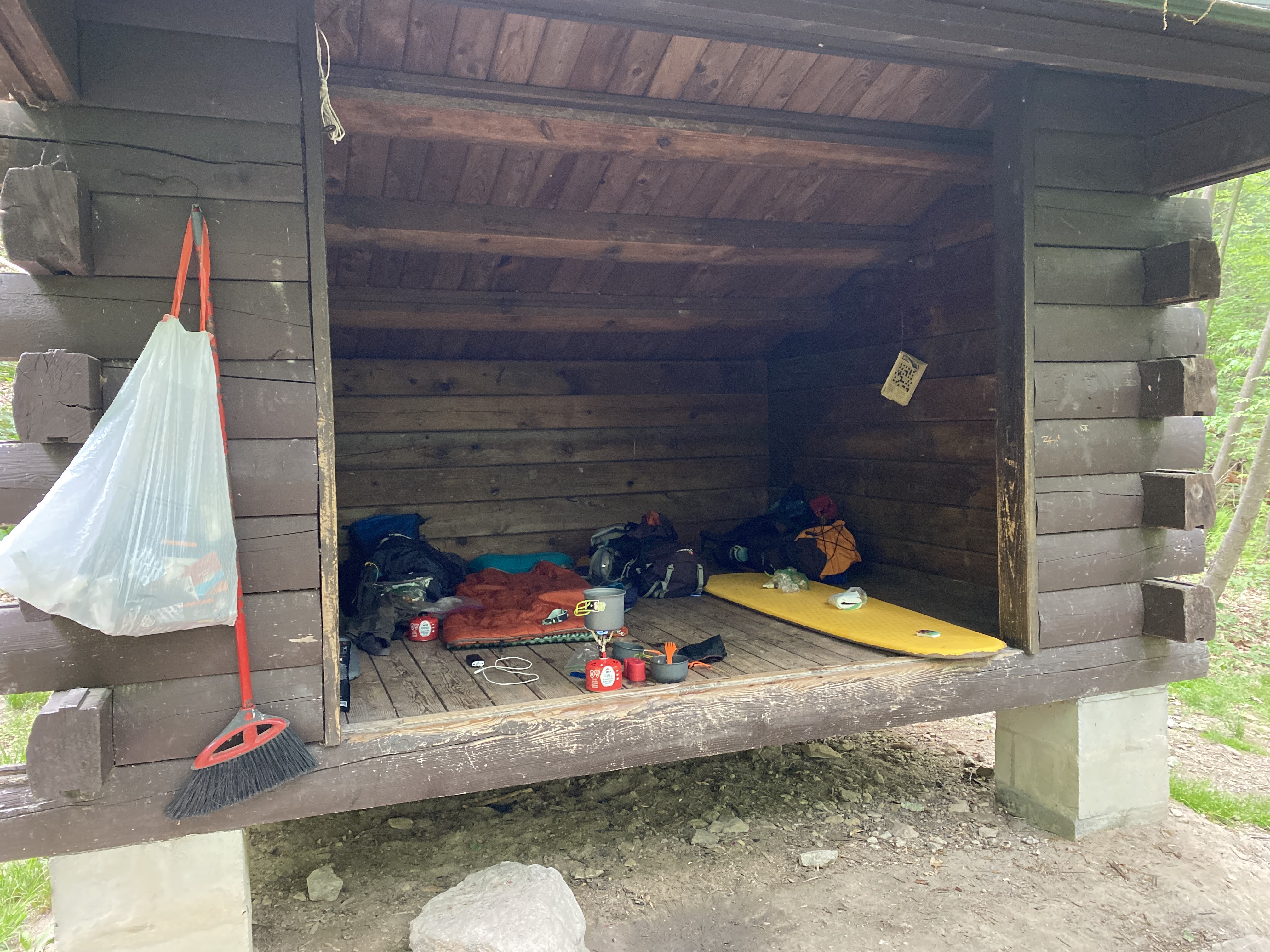
Quarry Gap Shelter was immaculate and well maintained. Of all the shelters we encountered during the weekend, this was the most scenic and quaint. The spring was also nicely kept and picturesque. One might confuse an overnight stay here as "glamping". It felt really good to sit down at the shelter when we arrived.
We were able to secure a picnic table at the shelter and made our lunch. Again the boys enjoyed picking and preparing their meal while I made my first attempt to replenish our water supplies. Dad lent me his Katadyn pump water filter (similar to this one) which worked great to fill our bottles and bladders. I also tested out an integrated filter straw from Epic Water Filters that fits in a Nalgene bottle. This was a really convenient option to fill and go. The only downside was that it only allowed you to drink about 18 ounces out of the 32 ounce bottle due to the filter vents sucking air into the straw. This would force anyone to have to carry two bottles or have a regular water source to fill up. In the heat, 18 ounces for an adult only lasts a couple of miles. Another lesson learned on this trip was that bladders are not the most convenient way to carry water as you need two people to filter the water and fill the bladder. If I was out there on a solo hike, I would have trouble refilling the bladder regularly. Luke carried two 32 ounce Nalgene bottles and that seemed to work fairly well for him and it would be a good solution if you have a way to carry them easily.
Here is the Relive video of this segment:
After lunch and refilling our water supply, we continued our hike towards Caledonia State Park and eventually Rocky Mountain Shelter. The trail leading from the shelter was really nice and flat including more Rhododendron tunnels, pine tree lined trail, and a steady descent all the way to Caledonia State Park. What we didn't anticipate was the pounding on our feet making the descent, the rising temperatures, and the toll it would take. When we reached Caledonia, we needed a good break after only two miles. That is exactly what we did. We found a nice picnic bench area, took off our shoes and socks, raised our feet and relaxed for a good 45 minutes. After the break and on our way out, we snapped this picture while we crossed the bridge over Conococheague Creek and then made our way across Route 30.
The rest break worked but we knew we had a tough hill to climb ahead of us. You can guess by the name of the shelter, that the next segment was going to be challenging. Rocky Mountain Shelter is nestled into a peak of 1700' of boulder formations. This was slow, technical, and tiring climbing for all of us. We traveled very slowly, rested frequently, and just kept putting one foot in front of the other while marveling at the rock formations. Andrew and I reminisced about our climb up Camelback Mountain in Phoenix a few years ago. This was one of the only sections that we saw very few people hiking in either direction. I think crossing Route 30 from Caledonia kept people from going this way, not to mention the terrain.
It was a pleasant site to see the sign to the connecting trail to Rocky Mountain Shelter. However, that was quickly flipped on its head when we realized we would have to hike back down the mountain a quarter mile to the shelter!
When we arrived to the shelter, we learned there was a scout troop taking up most of the camping areas and one of the shelters was already occupied. We were also low on water and needed to refill. The spring was located another quarter mile down the mountain and we would have to hike back up. We made a mistake at this point and actually carried our packs all the way down to the spring, rather than leaving them in the unoccupied shelter to reserve our space and lighten our load. In my worry that we would not find a place to set up camp, I told the boys that we would regroup at the spring and decide what to do from there. Andrew suggested we try hiking to the next shelter which we did contemplate. I was actually hoping to walk along the road located at the spring to find an easy way to potentially hike to the next shelter at Tumbling Run. However, that plan quickly dissipated when I looked at the map and saw it was another 6.5 miles away! Based on how bad our feet felt, there was no way, we were beat.
After refilling all our water supplies, we headed back up to the shelter. With the short break at the spring, we felt much better and the hike back up felt shorter than it felt going down. Fortunately for us, the shelter was still unoccupied and we found our home for the night.
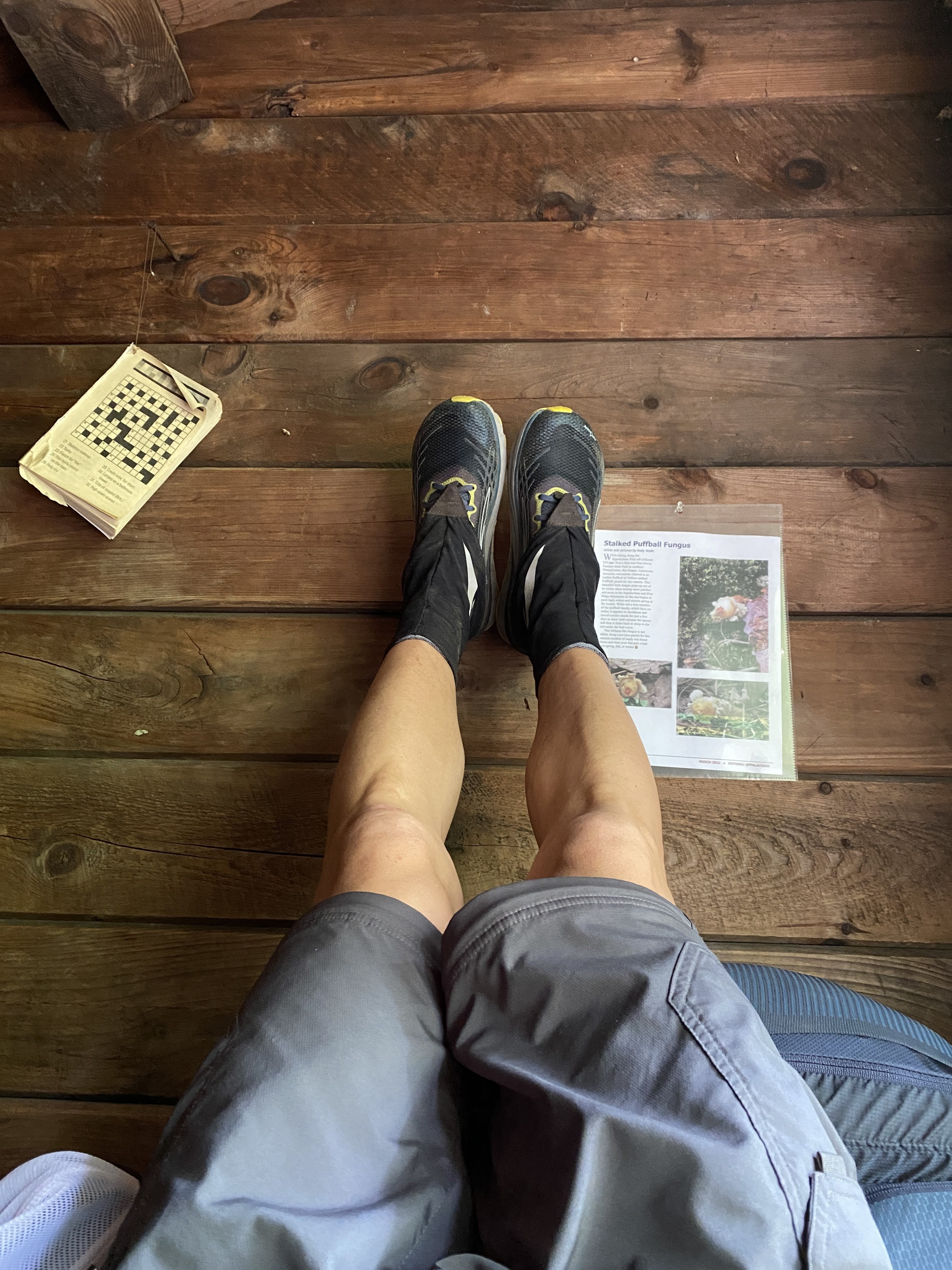
We settled down a little bit after 4 PM and stuck our legs up on the shelter to relax. I taught the boys about the benefit of elevating your feet and they learned for themselves how great it feels on the back and legs! I knew the boys were feeling better because their chatter turned to food again and they began making their dinner. I was not really hungry so I waited and continued to rest my feet.
Having a shelter was really nice because we did not have to make camp at all. This was a huge savings of effort for the afternoon when we arrived and for Sunday morning when we wanted to get going again. The shelter fit us very comfortably and we actually offered to share it with a group of three other hikers that came through later that evening. They elected to hike to the bottom and squeezed in among the scout troop. We also had a few critter friends in the shelter. We had a very large spider that we "swept" out of the ceiling. After looking it up, it was a very large dark swimming spider.
After eating, Luke and Andrew caught a second wind and wondered if we should try to hike to the next shelter again. I knew that would totally bury us and convinced them that the additional recovery would help us for the fifteen miles ahead of us on Sunday. They settled down and made a small fire in front of the shelter to occupy themselves while I finally made my dinner.
Shortly thereafter, we laid down and tried to fall asleep. It took a bit of time, but we were soon asleep before the sun went down. While we were sleeping in the middle of the night, a small mouse began making a mess of a roll of toilet paper. I am not sure whether the mouse was eating the paper or just taking pieces of it to make a nest somewhere. I ended up chasing it off with the light of my head lamp. Otherwise our food and trash were safely stowed away in a bear box down the hill from the shelter.
Here is the Relive video of this final segment on Saturday:
Like Saturday morning, we were awake as the sun rose around 6 AM. The boys went straight into breakfast mode and we were packed up ready to go around 7:15. We had to make one more trip to the spring down the hill (this time leaving our packs behind) and then we were off for the final fifteen miles at 7:44 AM.
The final day of hiking was going to be our longest and most difficult. It included multiple steep climbs, large descents, and tough terrain. I would be lying if I did not admit I was a little worried we might end early based on our performance on Saturday. I suggested that we take frequent five minute breaks and catch our breath regularly on the climbs. Every time I asked the boys if they were "ok", they said, "yes" and continued on. I was ready to throw in the towel at the first sign they were finished. To their credit, they stuck it out and just kept going.
We enjoyed a quick break at Tumbling Run Shelters which had a nice spring to fill up and some cool shade. We continued down the descent into the Old Forge Picnic Area in time for lunch. Antietam Creek was wide and swift moving. We took our shoes and socks off and soaked our feet for several minutes. This was a wonderful relief and rejuvenated our spirits! Again, the boys ate like kings and were high on their horse again to get going.
Before venturing off, we looked at the map and decided to break up the last few elements to give us small goals to count down to the finish. We decided to do it by the number of climbs left, which was four. The first was up to Deer Lick Run Shelters and then a small one at Baily Spring. Just past Old Route 16 would be our biggest test of the trip. Then the last one was a short punchy climb up to Penn Mar just after crossing Red Run Falls Creek. This was a really useful way to stay focused and help the boys count down to the end.
We arrived at Deer Lick Run Shelters around 2:00 PM and with more than four miles to go, I knew we were not going to make our 4 PM meet up time. I texted my wife Tammy, to let her know that we would be running late. I made another mistake at this shelter in my effort to refill our water. As we approached the shelter we crossed Deer Lick Creek which was a fast moving creek and sufficient to fill our reserves. As we laid our packs down a "sectional" hiker came up from the South. She asked about the creek and whether it looked safe, which I obliged. However, I was stubborn and wanted to find the spring head rather than following my own advice. I also did not consult my guide book and just set on the trail to the spring following the blue blazes. Low and behold it was more than a quarter mile away and a royal pain to get to! This did not help at all to keep us on track, but it did give the boys a much needed long break. Despite my frustration, in hindsight this turned out to be a blessing as the road ahead was still challenging.
Shortly after leaving Deer Lick Run Shelters we encountered another wildlife friend, a very large black rat snake! I must have been day dreaming because I nearly stepped on it lying in the middle of the trail.
We trudged along the trail and made it over the second small climb past Bailey Spring and approached the largest of the climbs in this last section. Red Run was a river running along Old Route 16 and we refilled our water supplies again. We rested for a good bit and started our way up. Ahead of us was a 500' climb over about a mile... it was steep. We stopped several times to catch our breath and just kept chipping away at it. There wasn't much talking so I knew we were all suffering. Andrew had a sore back, Luke's hips were rubbed raw from his pack, and my feet were in agony. We nearly reached the top and I decided to pull an audible and breakout some caffeinated energy gels and give them to the boys. When I packed them, I decided it was only if we were feeling rough and if I felt we needed them. This was definitely the time. The boys excitedly tore into them and off we went. It wasn't even five minutes later when Andrew started talking about Star Wars theories... at that point I knew we were going to finish this thing! From here on out, the last thing on my mind was taking pictures along the way... we were focusing on the effort to finish.
After finally summitting, it was an immediate steep descent into a gorge carved out by Red Run Falls Creek which was absolutely beautiful. The trail was right on the edge of the river and it was a little unnerving, but the view was terrific. We crossed the bridge to the other side of the river and prepared to climb out of the gorge towards Penn Mar. This turned out to be a real challenge as it was really steep! But the boys and I knew we were close to the end and just kept chugging along. We reached the flat railroad bed at the top and knew we were nearly finished!
We made our way to the Mason-Dixon line and stopped for some pictures. At that moment, I was feeling a bit disappointed that the boys did not get to meet or see a thru-hiker. Just as I was thinking that, a gentlemen approached after we took our picture at the sign and I saw him pull his phone out to take a selfie at the sign. I asked him if he wanted me to take his picture and he obliged. He then said, "Another state down." Right then I knew he was a thru-hiker! He started his journey from Springer Mountain, Georgia on March 8th and here he was at the Mason-Dixon line at the same time as us, just 33 miles short of his halfway point on the trail. The only regret I had in that moment was I forgot to ask him what his trail name was! Anyhow, the boys got to see someone with the determination and courage to take on such a task. For that I am grateful.
Along the way to the park, I asked the boys what their favorite part was, and they both said, "the food!" Geesh, what a perspective! Andrew also said he would only do another trip if the trail was flat. I am guessing after some time, he will change his mind. Something also tells me that in five or ten years from now they will remember this trip for a whole lot more reasons.
Final Relive video for our Sunday hike:
Overall Statistics for the Trip:
Total distance traveled = 35.23 miles
Total elevation climbed = 5,489'
Total Moving Time = 14 hour 13 minutes
Average Moving Pace = 24.3 minutes / mile
Total Elapsed Time Hiking = 19 hours 17 minutes
Overall Pace = 32.4 minutes / mile
A big thank you to everyone who supported our adventure including Pop Pop, Grama, Grampa, and especially the mothers, Tammy and Heidi. You two were good sports letting us chase adventure!
Are you sick of hearing 2020 was NOT the year we expected... well, I am. However, it was probably just fine and has been lined with many blessings. At least that is what I am trying to do with this post.
On the training and racing front, there were zero "real" races. I mocked up my own races, participated in a whole host of virtual events, and enjoyed virtual racing on Zwift including team time trialing. I would have never considered some of these things if not for COVID. Here is the list of virtual events and challenges that I took on this year:
I was fortunate to stay healthy and set a few new personal records for multiple distances and disciplines. I set a new 5k, 10k, and half marathon personal record. I set and then beat my 40k time trial personal record. Granted, I had never done a stand alone 40k, but out of the five attempts this year (standalone or part of the Ironman VR series), I improved over five and half minutes from my slowest to fastest effort. Last and certainly not least, I beat my 10 hour goal time to tackle the Appalachian Trail from the Pennsylvania border, through Maryland, West Virginia, and to the Virginia border. Both my half marathon and AT efforts were supported by my dad. I really enjoyed the extra time with him, especially now due to quarantine keeping us separated.
As expected, every in-person race I registered for was cancelled and immediately deferred to 2021. The only exception was the ITU Age Group World Championships in Edmonton, AB. That was a roller coaster of developments from July to December. At first it was all moved to Bermuda, so I declined my position on Team USA. Then, it was back on and moved back to Edmonton, so I quickly emailed wanting to change my decision. When it came to register, low and behold they did not have me on the list because of my initial response. Therefore, I acted swiftly and was reinstated. Therefore, we are trying to go back to Canada again next year! We'll see!
On the home front, life with my wife and kids has been very eventful trying to manage virtual school and maintain our health. Fortunately to date, we have not caught the virus and continue to self quarantine and follow as many precautions as possible. It is very difficult socially because everyone has such divergent views. We are managing our responsibilities to my employer (thankfully I still have a job), our family members, and the family members which are relying on us to keep our kids safe and healthy so they can still participate in some social activities. It is quite the juggling act and I know feelings have been hurt. Hopefully, we can all repair our relationships when all this is over.
Lastly, and not as much along the lines as blessings, my older brother was diagnosed with ALS this past summer. This has been a big blow to the family and we are certainly doing our best to rally around him. It is difficult because he lives in California and none of our family lives there. With all the COVID restrictions on travel and quarantines, it is a delicate balancing act to provide support. Maybe the blessing is we are all trying to work together to support one another in this crisis. 2021 will have a lot to say about this situation.
Anyhow, no need to prolong this 2020 recap... it has already been a long year!
These are certainly unprecedented times we are living in right now. COVID-19 is certainly wreaking havoc with local, regional, national, and international racing right now. My heart and prayers go out to everyone impacted by this pandemic. I hope our local race directors and event companies are prepared to weather the storm. I for one will be more than willing to leave my race registration fees with them to keep them "whole". The registration fee is simply my party fee for all the training I put in to prepare for the race.
My first race casualty of the year was the B&A Trail Half Marathon in Severna Park, MD. We learned of the cancellation earlier this week. Fortunately, a running race is easily replaced with your own run on your own course somewhere. Therefore as soon as I received the news, I started planning my own mock race on the Torrey C. Brown Rail Trail (aka NCR Trail).
Enter my amazingly dedicated father! At 77 years old, he is always up for an adventure. He first suggested that he would love to drive to each of the roads that cross the trail and cheer me on. That would be four different spots that would require him to drive over 50 miles to accomplish. But after a few discussions, he decided that he would like to ride alongside me on my old bike. "Are you sure dad?!" He said he would ride for as long as he could, stop, rest, and ride again. Ok... let's see where this goes.
Saturday morning arrived and it was a brisk cool morning, about 42 degrees at 6:00 AM. I had set up my old mountain bike by lowering the seat and swapping out the pedals so my dad did not have to deal with the old foot straps. We met at 6:15 AM in my driveway. As it was still dark, we both made our way to the trail with our head lamps on. I could tell my dad was nervous about this but he did not say a word. I commenced with my warm up as I would have and left him there in the dark for a while. When I returned, he was set and ready to go. Of course, I wanted a selfie before we started.
The sign behind us captured our plan perfectly. I would run out in front and he would follow at his own pace. At about 6:45 AM, at first light (as you can see in the background), "the race" started! I am not going to go into much detail about my effort, as I met all my goals that would have been before me if the real race had taken place. I wanted to PR my half marathon and test my mental capacity to handle the "hurt locker" I was prepared to go into in order to achieve it. This blog is about my memory of spending time with my dad. This story is the best way to explain the relationship and dedication we have grown to have for each other since I started racing five years ago.
As I approached the turn around point on the trail, I did begin wondering how dad was doing and if he would be right behind me as I turned around. Alas, he was not. In a way, this encouraged me to remain steadfast on my pace and know that I would encounter him soon. About a mile or so after the turn around, I saw him in the distance. As I approached and he realized I was coming towards him, he decided to dismount and offer me the water bottle as we had planned. When I was about 100 yards away, he proceeded to tip over and fall to the ground! I said, "Oh s#&t, are you ok?" He quickly said, "Yes!" He dusted himself off and still offered me a drink! I said, "Are you sure!?" as I was quickly approaching and preparing to stop if he was not. He said, "Yes!!" again and in a way that told me not to ask again... his pride might have been hurt. I totally understood this!
So off I went, marveling in the fact that at the point I saw him he had ridden over five miles and only stopped twice. Keep in mind, dad told me it may have been over fifteen years since he had ridden a bike! I pretty much knew by now that he would not be keeping up with me on the way back, but his presence was never forgotten and helped propel me to push harder towards a negative split on the run.
In the final miles, I was in pure darkness trying to push as hard as I could the whole way home. I had passed several folks I recognized on the way back with little more than a grunt or even a peace sign. Though, I had comfort in knowing if dad was in trouble there were many folks available to help. I soon reached the finish and immediately turned back to walk towards where he would be riding. It was less than two minutes before I recognized him coming down the trail.
As he approached, I could tell he was suffering. He was suffering far worse than I was during the final miles of my run. He glided towards me and I basically caught him and the bike to steady him. He had ridden the entire way back without stopping once, another five or so miles! He had stopped one time previously, so this totally pushed him past his comfort zone. He was shaking like a leaf and said, 'I am alright.. my legs are just numb... my heart rate is fine though!" Through all of that, he kept the presence of mind to maintain an understanding of how he was feeling. He could hardly stand on his own and I helped him dismount. We stood there and I was far more proud of his accomplishment than mine. His willingness to exhibit his suffering, to accept the help, and to take the time to recover demonstrated so much to me.
We slowly walked back from the trail to my house. By the time we were halfway, he was feeling fairly well and we just chatted about the experience. He even helped me stop and fix the kid's bounce back in the yard. I invited him into the house to warm up, taking the chance that my wife would be upset being seen in her PJ's. Indeed, everyone was awake in their PJ's in the kitchen. My dad was so happy, excited, and talkative with the kids. I could tell he felt so alive! I was so happy for him! March 14th is now memorable for three reasons, first it was his mother's birthday, this would have been here 101st. Second, it is the day I proposed to my wonderful wife. Third, it is the day that dad and I suffered together and loved every minute of it!
I reflect now that this man is the example of strength, perseverance, stubbornness, adventurous, dedicated, passionate, and craziness that has created me. His silence is not anger or frustration but of constant deliberation with himself and on subjects that are close to his heart. By learning who my father is, I have learned more about who I am. I will forever be grateful for this memory and the many we have created together on the road to my races. I love you dad! Thank you for all the support!