At 38 years old, I was forty pounds overweight, prehypertensive, and feeling lost in many aspects of my life. Changes needed to be made. I started walking every morning as a New Years resolution which led to jogging, then running, then running and cycling, and then running, cycling, and swimming. I had become a triathlete. This is a blog about my triathlon journey, becoming disciplined and finding the freedom that comes with it.
Backpacking friends and family always talk about West Virginia with fondness. I was anxious to find a trek that was convenient for a weekend trip and yet far away enough that it felt like an adventure. My dad loaned me his signed copy of Michael V. Juskelis's book, "The Mid-Atlantic Hiker's Guide: West Virginia." Dad was a frequent hiker with Mr. Juskelis so I knew it was a reliable source. I began planning this hike in August when I became the new outdoor activity coordinator for my son Andrew's scout troop. I was immediately attracted to the options described in George Washington-Jefferson National Forest in the Lee Ranger District due to its proximity to where we live. Within a 3 hour drive from north of Baltimore, it offered rugged, rocky, and steep terrain with multiple rivers, streams, mountains, lookouts, and camping options. I zeroed in on the Pond Run-Racer Camp Hollow Trail loop that includes portions of the Tuscarora Trail. The Tuscarora Trail stretches for 250 miles through Pennsylvania, Maryland, Virginia, and West Virginia. Below is a map of our initial plan.
Our trip began immediately after Andrew arrived home from school on Friday. Andrew, my nephew Luke, Andrew's friend Keegan, his dad Mike and I linked up and departed at 3:30 PM. We knew traffic would be heavy and anticipated it would take a little over 3 hours to get to the trail head. Also due to the time of year, we knew we would be hiking in the dark. As expected, the traffic on the Baltimore Beltway was slow until we reached I-70. In Frederick, I-70 slowed but we soon turned off onto 340 S towards Harpers Ferry and found a steady flow of traffic. We stopped for dinner at Sheetz in Charlestown just before reaching I-81 to head south towards Winchester, VA. The Sheetz was adjacent to the Charlestown Race Track and we saw all kinds of race track culture walking in and out of the store. We were treated the rest of the way to some very animated banter by Andrew after he had finished a caffeinated beverage.
Eventually, we made it to Wardensville, WV and wiggled our way through the back roads and eventually the cinder roads of the National Forest. The book was very precise about the trailhead being adjacent to a one-lane bridge and we knew exactly when we had arrived in the correct location. We disembarked and were immediately surprised by the sound of Pond Run. The recent rains clearly had swelled this watershed and we were in for something special. We laced up our hiking shoes and made our last preparations before taking a quick group selfie in the dark and headed out on our journey at 7:40 PM (sorry my iPhone flash was not powerful enough to reach Mike and Keegan).
The blue-blazed Pond Run / Tuscarora Trail started on the south side of Route 5/1 Waites Run Road and on the North side of the one-lane bridge. All three boys were working on their backpacking merit badge for scouts, of which I am a counselor. Since this portion of trail was a relatively straight shot, I had each of them measure the bearing on their compasses from the trail head to our destination. I continued having them check the bearing as we went to be sure we were trending in the correct direction. After a short down hill section to reach the river bed, we hiked along the run for the majority of this segment. The trail makes an abrupt change in incline to climb approximately 1200' to the campsite.
The guide book indicated the trail crosses over Pond Run "several times." Due to the heavy rains that passed through the area on Thursday night into Friday, the Run was swelled. We were forced to improvise our way across as the typical path was not always obvious. Ultimately we crossed Pond Run seven times and this served as an opening salvo on our journey to realize we were traversing some technical terrain. I attempted some video of this effort but unfortunately it was simply too dark and our headlamps did not provide adequate lighting. Ultimately, none of us escaped with completely dry feet and we wondered what we had gotten into.
We arrived at the campsite which was at the intersection of Tuscarora Trail and Halfmoon Trail just before 9 PM. This 2.4 mile section took us under two hours and we were happy to set up camp and call it a night. The campsite had plenty of room, many flat soft areas for pitching a tent, and a fire pit with log seating. We elected to eat a snack before bed and quickly retired for the evening. Andrew and Luke had their single man tents, Mike and Keegan shared a nice REI two-man tent, and I used a new Outdoor Research Helium Bivy Sack that I have been itching to test. The wind was fairly stiff so the ~45 degree temperatures felt more like it was in the low 30s. It was nice to slip into our warm sleeping bags for the night.
Morning arrived slowly due to the high winds; it was a noisy night. At sunrise around 6:40 AM, our camp began to rise. Andrew and Luke are always good about packing up their gear before making breakfast. This morning was no exception. We had strung up our food bags on a nearby tree in which Luke helped me lower down. None of us had to refill water as we had packed enough fresh water and went to work preparing our meals. Finally in the daylight, we could get a good look at our surroundings. We had clearly missed the peak Fall foliage and could see through the trees in 360 degrees. To our East was Mill Mountain with a peak 3,173' which we would navigate around later in the day. To our West was Halfmoon Mountain which includes a look-out at an elevation of 2,826'. That was our first destination for the day.
Just before 9 AM, we finished packing and hiked to the West-Northwest along the Halfmoon Trail. We planned an out-and-back section so we could witness the views from the lookout before embarking on our main trek of the day. From our campsite, the trail dipped down into a small valley before climbing back up to the lookout. Along the way, the boys practiced "staying found" by following along a map I provided to them. We practiced looking at landmarks and also interpreting the real terrain with what they saw on the map. It was fun seeing the light-bulbs go off in their heads as they were able to see their surroundings and relate the view around them with the paper in their hand. We also encountered our first backpackers coming from the lookout.
It took us about 50 minutes to hike the 1.3 miles and climb about 220'. We had completely shook off any chill that might have been in our bones from the wind. The stunning views of Trout Run Valley did not disappoint and we were greeted with waves of light snow flurries! Looking to our left and running south was North Mountain. Looking to our right running almost in parallel was Long Mountain. The wind was raw and strong but we still elected to sit down and have a quick snack before heading back the way we came. Being predominantly downhill, we were back at our starting point in half the time it took us to reach the lookout.
Just past our campsite, heading Southeast along Tuscarora Trail, we came to a boardwalk where we found a nice spring head and stream. Each of us took time to fill-up and prepare for our late morning stroll to Sugar Knob. Each of us had different strategies for water on this trip. Andrew had two 32 oz Nalgene bottles. One bottle had a built-inEpic Water Filterthat essentially operates like a straw within the bottle while filtering the water. Luke had two 32 oz. Nalgene bottles and he used my MSR TrailShot Water Filter. This was our first time using this one and it was really light, compact, and very easy to operation (see video below). Andrew also used this to fill his Nalgene bottles. Mike and Keegan utilized water bottles that they filled with the TrailShot as well. Unfortunately, Mike's filters on his HydraPak Katadyn bottles appeared to have "froze" up so they just refilled their bottles with the TrailShot. I carried two 500-ml Salomon soft flasks with XA Filter Caps. In hindsight, I wish I had brought one more to have some spare water for cooking or for our longer sections that lacked water.
We continued South along the Tuscarora Trail for about a half mile to a junction. We could continue along the Tuscarora Trail, however the route in the book took us along a 0.6 mile winding path on the Mill Mountain Trail. This contour trail led us to the ridge line along Mill Mountain and offered us a view to the North of the valley below and to the East of Sugar Knob. We skirted just under the peak of Mill Mountain and back to Tuscarora Trail and continued on a Southeasterly direction. The Tuscarora Trail at this point had become an accessible forest road which was clearly rutted by vehicles and we encountered several mountain bikers. After about a half mile, we reached the Sugar Knob campsites and continued down the Little Stony Run Trail to a cabin. You can reserve the cabin through the Potomac Appalachian Trail Club and unfortunately it was occupied when we arrived. Therefore, we elected to double back and eat along the Tuscarora Trail at a nearby campsite.
After eating some delicious meals, we refilled our water supply and headed back down Little Stony Run Trail to a nice spring head that was pouring abundant amounts of clear water. We all topped off and strapped our packs down for our afternoon jaunt. From Sugar Knob, we descended 400' down to the Racer Camp Hollow Valley below. It was at this point we had the boys make a decision. I had provided a plan and map to hike Northeast from this point along Racer Camp Hollow along the stream. We would be at a lower elevation but potentially have to cross the stream several times. Being that we were unfamiliar with the terrain and our fresh experience from the night before, crossing the stream with freezing temperatures over night was a bit daunting. I offered an alternative route to continue along the Tuscarora Trail to climb Little Sluice Mountain to camp at White Rocks. One concern we had was regarding the water options for the evening. We encountered a group of back packers coming down from Little Sluice Mountain and I asked if there was any water source at White Rocks. They indicated one was available about a half mile past the campsite. After much deliberation, the boys elected to go with the climb. Mike and Keegan refilled their water supply at a nearby spring head and away we went.
The Tuscarora Trail continued to be a fairly tame forest road heading East-Northeast and calmly traversed the contours. There were only a couple areas of steep trail to reach the ridge line of Little Sluice Mountain. All told, we reached the highest elevation of the trip at about 3,010' and traveled about a mile along the ridgeline before reaching the white-blazed White Rocks Trail. The mountain top was shaped in a saddle and it was not abundantly apparent that we were going to reach anything spectacular. We reached a campsite and we were all a bit disappointed to see several back packs laying on the ground. We looked around for another area to camp and fortunately found some areas that worked for us. Mike, Keegan, Andrew, and Luke's tents would be on some awkward pitches and my bivy was set up on a side trail that led to nowhere. In the middle was a nice fire pit in which the boys were chomping at the bit to get going in starting a fire.
I immediately became restless that "White Rocks" might have been a let down as I was expecting to be at the peak of the mountain with terrific views towards the west for the setting sun. I started to explore around the site and found that there were some cliffs nearby but seemed to be blocked by a fair amount of trees. However, after a few minutes of working my way around, I looked through the trees and saw a large white rock outcropping and knew that we were in the right place! As I approached the base of the White Rocks, I scrambled up about 25' to the outcropping of rock and walked out to the cliff's edge and was presented with a marvelous view that extended nearly 180 degrees looking into Virginia from varying points along the rock line. Starting with Capola Mountain to the East, then Tea Mountain beyond that, and then both were swallowed up by Little North Mountain beyond them. I returned to the campsite to report what I found and collected the group so we could go back and enjoy the view of the setting sun before dinner.
As darkness fell, we busied ourselves with collecting wood for a fire and made our dinner. The boys enjoyed their time building the fire despite the winds. They had diminished a fair amount but sudden gusts were still prevalent. While fixing dinner, a wind gust sent the fire outside the ring and started to consume Andrew's gloves that were drying a bit too close. They were our only casualty of the outing.
This was going to be our coldest night on the trail with predicted temperatures in the low 30s. At around 7 PM, everyone seemed tired and we each made our way back to our sleeping quarters to end the night. Sleep was still fairly difficult to come for all of us as the cold was indeed setting in. Additionally, the slope of the tents were not helping. It was a long night for all!
As soon as it was light, our site stirred and wasted no time in packing and preparing breakfast. We were anxious to get going and warm up! I rose fairly quickly as I wanted to see if I could get some pictures of the sunrise before getting everything organized. Boy was I happy I did that!
It definitely fell below freezing as some of the water remaining in our bottles was frozen and it took longer to boil than usual. Toes and noses were numb and the warm meal, coffee, and hot chocolate helped to resurrect our bodies. We were packed and back on the trail before 8:30 AM. We had to double back up the White Rocks Trail and back to Tuscarora Trail. As expected based on the reports by the backpackers we saw the afternoon before, there was a spring head about a quarter mile down the trail. I was the only one out of water and filled a single flask quickly and continued on. We continued to descend and reached the start of Old Mailpath and turned left. This was the end of our journey on the Tuscarora Trail.
Old Mailpath continued to descend all the way down past Racer Camp Hollow Trail and down to Waites Run. We finally reached Waites Run Road that ran along Wilson Cove and led us back to our parked vehicle. Even though we were on a road, the views were no less spectacular along the rushing river. There was a beautiful lake called Wilson Cove at the base of all three mountain watersheds that we traversed. There were also tremendous rock falls and cliffs running along the roadway. This was the first time the entire trip that we were able to walk 2 or 3 abreast. The boys chatted their way up the lane as Mike and I marveled at the great views back up the valley to the mountains we had previously navigated. In no time, we reached my car and the end of our adventure.
Here are the statistics from my Garmin files of all three days:
Overall, everyone did a great job of managing their gear, adjusting to the changing weather conditions, and navigating the terrain. I would rate this as a challenging hike despite the distances being short. This was also a "recon" mission for a trip I have to plan for Andrew's scout troop in May. There are some adjustments to be made, but I believe this will be a challenging hike for the scouts. Some scouts will no doubt struggle, but it will feel like an accomplishment for all.
We packed the car and headed up the road for our three hour drive back home. We enjoyed the views we were not able to see when we began our trip driving in the dark. The Washington-Jefferson National Forest is definitely a wonderful place and will no doubt remain on our list for future trips. For Andrew and Luke, this was their second three-day hike towards their badge while Keegan is just starting his badge requirements. However, Keegan is no beginner, he and Mike have done a ton of backpacking all over the country and we look forward to many trips with them in the future.
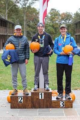
The last race of the season is always a bitter sweet experience. On one hand you are tired and beat up from the long season before it. On the other hand you are excited to race but also looking forward to the rest and recovery following it. I would be lying if I said I was as motivated as any other race to train for this one. But in reality it was a real struggle to stay on track. I was cutting workouts short and skipped three workouts in the weeks proceeding the race. Two of the three skipped workouts were due to an infection in my foot from my last race, otherwise a scouting camping trip prevented the third. Regardless, I was ready to race because I had a lot of fitness built up from my season and I was still confident to do my best on the day.
The River Valley Trail Run Festival offered a 5k, 10k and half marathon. I raced the half marathon in 2017. I finished fifth overall in that race and loved every second of the challenge. I knew I would come back to this race one day. The course this year was very different in route, but not different in challenge. The terrain was very hilly and the footing varied from fire road, grass path, corn fields, rocky, and to rock scramble. It included three river crossings and was as technical of any trail running I have done. In many ways, it reminded me of the varied terrain of the Maryland section of the Appalachian Trail. According to my elevation corrected Garmin files from the two versions, in 2016 there was 1,245 feet of climb and this year we climbed 1,676 feet. Below is a comparison of the two courses (2021=red, 2017=blue).
The race start time was 8 AM. I woke at 4 AM and executed a run warm-up around the neighborhood to get the body going. I had my customary pre-race breakfast of an oatmeal mix that I eat every morning. Breakfast by far is my favorite meal of the day! I packed my gear and left at 6 AM to drive 35 minutes to River Valley Ranch. River Valley Ranch is a really special place! It is a faith based camp for kids that is built to look like an old western town. The race starts inside "Fort Roller" which is a square made of the amazing bunk houses and a chow hall. It really takes me back to being a kid and dreaming of summer camp! The atmosphere at the race was amazing and you feel surrounded by God's creation!
Parking for the race was in a grazing field for the horses and sits way below the race venue in elevation. I learned from the previous race to pack all my gear and utilize the gear check at the venue so you don't wear yourself out going up and down that hill (not to mention completely soaking your shoes in the dewy grass!) I arrived before sunrise and was one of the first folks to hike up the hill and find a good place to get staged for the race. I hunkered down and just listened to some tunes while the rest of the racers arrived. This is always one of my favorite parts of racing. I really enjoy watching all the different approaches to getting ready to race. Quite honestly, I prefer to keep to myself and just soak in the atmosphere.
At 7:30, I drank my pre-race nutrition of corn starch, peanut butter powder, beta alanine, caffeine, and almond milk before I began warming up. I am so thankful to Sierra in sharing with me a warm up routine that starts right after I wake up because it always makes the warm-up right before race start so much easier. As I am getting older, I have found that it takes a lot longer to get loose and feel good. Because I already completed a solid warm up a few hours before, I feel fresh and ready with very little warm up just before the race. Thankfully, this was the case because they had organize into our corrals twenty minutes early. I waited until the very last call to enter the corral. They had an organized warm-up which was very entertaining to say the least, sang the Anthem, and most importantly led a prayer.
The start of the race was finally here and I was in the first corral to get started. I toed the line and we prepared to start. As we were waiting for the gun, the gentleman that mapped out the course indicated the first mile or so was suggested by a runner that was standing right next to me. I immediately knew this might be someone with whom I should tag along. Fortunately he was wearing all orange and was easy to keep an eye on all day. The first half mile of the course was straight down hill to the river and I knew we could just let the legs go and try to be in the front pack by the time we reached the first single track of the day.
They counted down and we were off! As expected, the guy who suggested the first part of the course set a fast pace and he clearly knew where he was going so I slotted in behind him. His pace was strong and comfortable for me so I was very satisfied to be with him. To my surprise, only two others really went with us. We were flying down the hill to the first hard left turn into the horse fields and down towards the horse barn. The grass was thick and wet but the footing was good. We had to check our speed as the hill became fairly steep and we were entering another hard right turn to go through the horse barn. We navigated that section cleanly and were off through the barn down the last part of the hill to the river.
We reached the first part of single track which was a rocky section with a fairly technical flow to it. I was holding tight to my guy in orange and could hear another individual running slightly behind me. I was very satisfied to be in second and in the front pack from the beginning. I could tell the pace was slightly high for me but I was feeling good and wanted to see how this would go for another couple of miles. We reached the first switch back and climb for the day and could see that the three of us were way ahead of the rest of the race. I anxiously watched our leader to see how he would treat the up hills and to my relief, he dialed back and just short-step chopped at them. The climbs were short but always punchy and provided no recovery all day. The real recovery was just letting your legs fly downhill to let the heart rate come down.
The first mile clicked away at 7:39 and I knew we were flying over the trails. This pace was pretty unsustainable for a trail race like this but we were descending back down to the river and continued along a single track that followed the river to mile 2. It remained very technical with a ton of rock and jumps to truly keep your flow. We made a right turn and entered our first real climb of the day up a fire road towards the paintball fields. I was pleased at this point as our leader and I had stretched our lead on the rest of the race to the point that we could not see third place or beyond. I felt strong up the entire climb and knew by this point I had found my rhythm.
We reached a sharp left and turned downhill snaking between the paintball barriers and really had to focus as the grade was steepening. This is always the best part of trail running. Your focus must remain high throughout which makes the miles just tick away. Time seems to fly as you are just trying to remain on your feet and glide over the terrain as smoothly as possible. We descended again down to the river and made our way towards our next climb. This climb started at mile 3 and was split between single track at the beginning where we had a few switch backs and then emerged into a corn field. I was very pleased to continue tracking along the leader up the hill and around the cornfield. We turned left back into some single track areas that emerged again next to another corn field as we made our way to the first hydration area just before mile 4.
I elected to carry my own hydration with a light Ultimate Direction vest which held two 500 ml flasks. I had one filled with water and the other with SIS Beta Fuel. I went with this vest over my Salomon Sense Pro 5 due to the potential of the river crossings. The Sense Pro has a padded back and storage area in the back that I thought might carry extra weight if it ended up wet. The Ultimate Direction ended up being fine although it does not fit as snuggly as my Salomon. I stayed pretty disciplined with hydrating and fueling throughout. The duration of this race was just over what I was comfortable with not having fuel. I have learned the aftermath of a race without fueling is not worth the savings in weight.
After mile 4, I started to notice I was slipping behind the leader a bit more and it seemed like he was definitely starting to surge (or I was slowing down). We climbed up a couple of switch backs and emerged onto a gravel road that included a steady decline. I knew I had to close the gap. I surged and clawed my way back towards the leader by the bottom before we turned sharply right into the largest climb of the day. I was winded but happy to be back in touch. This next segment of the course was very similar to the last time I raced here. It featured the most technical rock climb / scramble on the course and it did not disappoint. It included two forks where you could choose your path. Unfortunately, I chose wrong at both forks! Both paths were far slower and confused me more than helped me! At the second fork I literally had to stop and look around as I had lost the course. It was at this point I lost the leader and had a feeling I might not see him again. After the scrambles, we had a straight climb to the highest elevation of the race. We passed mile 5 and also the mile 11 marker which meant we had to do this one more time! I will not deny that I thought about that for a few minutes and realized I had to settle in and keep pushing.
Knowing we reached the highest elevation meant we would have a long descent back down to the second loop of this course. I did my best to negotiate the hill and take a gamble to see if I could make contact again with the leader. I reached my fastest pace of the day at 5:11 on that downhill, it was very exciting! We snaked our way around and back to Fort Roller to start our second loop. As I emerged out of Fort Roller and back into the horse field, I caught a glimpse of the leader whom had already made it to the bottom through the horse barn. He was gone! I let loose and felt the recovery of flying down the grass field and through the barn to our first river crossing.
This crossing was tame as it was a submerged road bed so the footing was perfect and you could leap step across with confidence despite the flow of the water. It was here that I found my shoe selection may not have been the best. I invested in a pair of Salomon Wildcross 2 Goretex trail running shoes. These are fantastic for keeping rain and dew out but I have learned that once water gets into them, it does not get out easily. My feet sweat a ton and I figured this out on my long training runs so I knew this might be a problem in the race. The shoes filled as expected and of course it took for ever to really get the water out. My feet immediately felt like lead getting out of the water and I just kept pounding away hoping they would squirt out eventually. Unfortunately, the next two miles required two more river crossings and they just refilled. We reunited with the previous loop around mile 8.5 and by mile nine, my shoes had finally started to feel normal again. In the past I have actually drilled holes in the soles of my shoes for quicker draining, this might end up being the future for this pair.
At this point of the race, I had not seen the leader at all and third place was still fairly far back as I could see him occasionally when we were on some switchbacks. We also started to overlap with some of the 10k runners whom started around 9 AM. This wasn't a problem at all as most of them were very considerate of faster runners and moving off to the side way before we would pass. I thanked them each time and also benefitted from the words of encouragement from a few of them. I continued to listen for any sign of third place making up time on me as I knew I was starting to fade a bit. I tried not to think negatively and stay focused on the course ahead of me and not behind me. Easier said than done.
After mile 10, I reached the long cinder road where I had made up time on the leader before. This time, I wanted to simply run as confidently as I could yet recover enough for the climb I knew we had remaining up the rock scramble. I made the right hand turn and onto the technical rocky single track. There were far more people racing and spectating the race at this part of the course which was a huge benefit! The cow bells and cheering was awesome and really helped pick my spirits up. I elected to go the opposite ways at both forks and successfully flew through the scramble. As I made the climb to the highest elevation, I caught a glimpse of third place and he was a lot closer than I had imagined. I knew it was time to put the rest on the line!
As soon as I reached the peak of the climb, I knew I had to let it all go down the hill and put whatever pace out there that I could. In the first loop between mile 5 and 6, I averaged a 7:31 pace with a max pace of 5:11. I didn't nearly come close to that in the same segment of mile 11 to 12 where I averaged a 8:12 pace with a max pace of 5:51. However, that is all that I had and at the end of the day it proved to be enough. I kept my perceived hammer down all the way back up the climb to Fort Roller where I rounded the fort and back towards the finish line.
The finish line atmosphere was awesome as so many people were there to cheer the finishers. The cow bells, music, and yelling was fantastic and filled my empty soul up! I crossed the line to my familiarly mispronounced last name in second place overall! I finished in a time of 1:48:30 and within 3:19 of the leader. I met Josh Ferguson at the finish and give a good fist pump and accolades for a job well done! Third place finisher Christopher Sufczynski came in 0:38 behind me and we were all wiped but satisfied with a great race!
Overall, I am obviously very satisfied with my performance at this race. This was an amazing celebration of a season of solid running. I really learned how to suffer on a run but maintain pace to lead me to some of my best performances ever. Compared to the last time I raced here, I beat every possible metric from my four-year younger self! I know at 44 years old, my time is limited in making improvements and getting faster so I am going to continue enjoying being faster than I was yesterday until I can't be any longer. My inspiration to race is still to compete, but every year I gain a new appreciation of what it means to be able to compete. I am blessed to have a healthy body, a family that supports me, an inspirational coach, and a luxury of time to train for such things. Racing continues to be a celebration of all these amazing blessings and to provide glory to God who grants them!
Like so many of us, I had to be flexible this year due to changing COVID requirements and restrictions. My family and I were all booked for a two-week trip to the Canadian Rockies to reboot the rescheduled 2020 AG World Championships. However in May, we learned that COVID had other plans... again. Therefore, I decided to build for a 70.3 rather than focus on Olympic distance all year.
New Hampshire was a state that my wife and I have never visited. Racing Timberman 70.3 was an easy decision. We found a nice two-bedroom condo on Air BNB about 3 miles from the race site in Laconia, NH. The accommodations were perfect for us and was a great home base for enjoying the lakes region and an excursion to Mt. Washington. Before leaving, there were reports that tropical storm Henri would be tracking straight for the south coast of CT and straight into NH. We were optimistic that race day would not be a wash but it was looking worse by the day. We were able to get some beach time and other outdoor activities in between scattered showers for the majority of time we were there. By Saturday evening, it was looking like Henri was going to make its presence during the race and the question was how wet and windy would it get! My coach Sierra teased me and said, "If you run fast, you won't get wet!".
Race week went fairly well and as anticipated, I did not feel all that great leading up to leaving on Thursday morning. Taper always feels weird for me. We arrived in NH and drove around quite a bit before we could check in to the Air BNB. Unfortunately, I did not get any shake out run or swim in. Friday morning I woke early to ride as much of the hilly part of the bike course as I heard the road conditions were rough and I wanted to get a feel for all of that. I went long on the workout Sierra provided but I made sure to go easy on the rest of the ride and just coast down the descents. Although, it did not get passed Sierra that I did this. Later that morning, we visited a local beach and I was able to get a good open water swim in. The water felt fantastic and I was fairly sure we would not be wearing a wetsuit. Saturday morning began with a run and a swim. I swam as close to the swim course as possible to get the site lines. The water felt fantastic and I was sure the water was too warm to be wetsuit legal. My body responded well to the last two days and I felt ready to go!!
Race morning arrived and we had a nice consistent breeze before the sun was up. I attempted a new warm-up process that Sierra shared with me. Immediately after waking, I headed out for a run mixing in some strides and picking up the pace. I returned back to the condo and had my normal breakfast of my oatmeal mix recipe. The goal was to get a short ride in at transition and get in the water for some warm up swimming. Unfortunately, with the set-up of transition, the traffic, and road closures, getting my bike out of transition for a ride was not an option. Then came the drop off; parking at this race was terrible. I had to quickly set up transition and hand my bag back to my dad so he could go back and get my wife and kids. Therefore, I had no choice but to try and jog around and get my heart rate up. From there, I had to wait for my family to get back to the race site so I could hand off the last of my belongings. I had my homemade "UCAN" mix of cornstartch, whey protein, beta alanine and peanut butter powder with almond milk while I waited for them. The timing to meet them and to get into the water for some warmup was perfect. We met up, quick pictures and a kiss and I headed to the water. I entered the cattle gates to try and enter the water, however they did not let the age groupers swim. Everything was blocked off for self-seeding and the pro women's start. Oh well, next time on the warm-up protocol! I wasn't worried, I was plenty warm and jazzed ready to go!
Opechee Park is situated north of the downtown area of Laconia on Opechee Bay which is situated between Lake Winnisquam and Lake Winnipesaukee. It was well protected by trees so the lake surface was not impacted by the winds. The day before, the lake temperature was 76.3, but overnight winds and temperatures dropped the measured temperature to 75.4 for a wetsuit legal swim. I was prepared either way. We had a time trial start and I set up in the third group, 30 - 33 minutes. It took about 2 minutes to reach the starting mat and I was off. I was fortunate to work in and out of some slower swimmers early and link up on some feet that were maintaining a good pace and line. As I reached the first turn buoy, I was very settled and comfortable with my swim. At this point, I noticed quickly that the feet I was following made a wide turn and did not stay on line so I dropped off and moved into my own line along the buoys. Eventually, I found another set of feet and held tight to the buoy line. Nothing more eventful happened other than I was literally swimming under the buoys to remain as straight as possible and stay within the draft. Overall, I considered this as one of my best executed swims to date and the time did not disappoint at 30:04! I was 3rd in my AG coming out of the water!
I made my way into transition and smoothly worked my way out of my wetsuit as I ran, and I pulled my Team Stages kit up and over my shoulders! I really fell in love with the Castelli suits this year! I made my way to the mount line and out onto the bike course. The first 25 miles of this course was a dream with a predominately downhill mashers paradise! I averaged a good speed with a low perceived exertion as planned. I just stayed patient, focused on my nutrition, and remained comfortable. I had forgotten my computer bike mount at home so I was forced to do the entire ride by PE which is something I have been working on quite a bit, so this was actually a blessing! Ultimately, my watch didn't even keep a consistent connection to my power meter so I have no power data to reflect on.
The winds were steadily increasing the entire ride and a few cross wind gusts made me really happy that I decided NOT to ride a disc wheel. With the flats over, I knew the hard work was yet to come. The final 31 miles is where all the elevation gain was, with over 2,000'. Fortunately it was well protected with trees and the winds were less of a factor. I had practiced this portion of the ride earlier in the week to get a feel for the descents and the road conditions. The word was that some of the roads were pretty rough. Indeed they were and I was very happy to have some prior knowledge of what to expect. At this point, I stayed within myself on the climbs and did my best to bomb the descents. Looking back at my GPS, I reached a top speed of 48 mph! That was fun!! Staying focused on my nutrition has been a problem in the past, but with the help of an alarm every 15 minutes, I kept to the plan and felt really good throughout the ride. I enjoyed the ride and feel I executed it very well without burning too many matches. I started feeling some fatigue in the last major climb, so I dialed it back a bit and just stayed patient to the last descent into town. I finished the ride in 2:32:07 which was 5th in my AG.
As I made my way back to town and prepared for the run, I stretched a bit and made sure I was unstrapped from my shoes early. I dismounted cleanly and made my way back into transition. I must have done a decent job on my dismount because my wife's video captured my daughter saying, "man, he is fast!" I love my daughter! Again, nothing eventful happened as I rolled my socks on, slipped on my shoes, and made my way out onto the run course. I practiced pre-rolling my socks and having them in my shoes to roll back on, this worked perfectly! I did elect to carry some nutrition with me as I felt the aid stations were spread out a bit farther than I would have liked. They were not every mile but more like every 1.5 miles. I hit the first one right out of transition to get a nice start. I had a few Maurten gels on my race belt and hit them as needed.
The first half of the run was right on track. I clocked the 6.5 miles at an average pace of 7:09 minutes / mile which was right in line with my target. I did notice though that the hills were short but steeper than I anticipated and took their toll. I knew the second lap was going to be a slug fest to keep my pace up but I was determined to meet my goal of a sub 1:40 run. I stayed committed to my salt intake and grabbing plenty of nutrition on the course. I ditched my nutrition bottle as I forgot to close it after one drink and it spilled out completely. I didn't miss it though! Ultimately, I had no GI issues and no cramping. My feet however were a different story. I have yet to find the right shoes for running the half for a 70.3. The pain was starting to get in my head and slow me down. Ultimately, I just kept trying to stay positive and keep moving to reach my goal. I fought like mad to keep running up the hills no matter what pace and push as hard as I could on the downhills to make up some time. I slowed down to an 8:06 pace for the second half which cost me a few AG places. Despite that, this run was a major success compared to my previous 70.3 runs where lack of nutrition, hydration, and over biking have plagued me. I'll take the 1:38:55 run which was 11th in my AG and enough to maintain 5th in my AG overall! The exciting part is I feel I have a lot more upside potential on the run for future races!
As I made my way to the finishers chute, I saw my family cheering me on and enjoyed the run up the red carpet to the finish line! Within two minutes of finishing and hugs with my family, Henri finally arrived with his rain and wind! Coach Sierra was right! I ran fast enough to beat Henri to Laconia!
Hindsight thoughts:
1. Nutrition was a huge WIN for this one. I experimented the last few months with making my own "UCAN". It is just cornstartch, so I bought a big tub of it and make my own mixes for a fraction of the cost! On the bike, I had water in my BTA and refilled at one aid station. I had 1 Liter of SIS Beta Fuel with added sodium and caffeine. I also had a gel flask filled with UCAN Edge packets. I'll work on making my own version for future races. On the run I used a bottle with SIS Go Electrolyte mix which was concentrated in a 8 oz. bottle. I didn't use this much because I spilled it, but otherwise Gatorade endurance, Maurten gels, and Red Bull late in the run all worked well! I also used Salt Sticks chewable salt tabs. Not the best tasting but they dissolve and I don't have to worry about swallowing a capsule which is a big problem for me now. I had only one moment on the bike where I felt like my gut was not emptying so I skipped one 15 minute alarm to let it clear. I had a side stitch develop about a mile into the run but it was not very intense and subsided in a couple of miles (can't remember exactly).
2. I had high hopes for the warm-up protocol and will continue to plan and toy with this to make it fit race conditions. I improvised on race day and did not panic. I was ready and not doing it exactly had NO impact on my performance.
3. Not having my bike computer was a small inconvenience on race day and did not worry me at all. I had done a ton of training rides on similar terrain and had an accurate feeling in my mind about where my PE should be. I am a bit disappointed to not have any data to look at after the ride to see how my PE lined up with my numbers though. C'est la vi!
4. This one will be a little raw but I have to acknowledge it. Traveling and racing with family is a challenge and takes a lot of prep work and communication. There were several moments of stress leading up to race start that I did my best to not derail me. My dad knows what I need, where to be, and what to do because he goes to all of my races. He was a huge factor in helping adjust to the other factors that were not in our control. I have a lot of family coming to Lake Placid so the lessons learned from this one will help reduce the challenge, but I can guarantee it won't be a cake walk.
5. My hydration set up on the bike worked well. I had a BTA 28 oz aero bottle, a 500ml downtube aero bottle, and 500ml bottle BTS. Thinking ahead to a full distance, I can easily go with two 1-liter bottles BTS and just refill the BTA several times. The gel flask worked well for four UCAN Edge pouches. Unfortunately it did not stuff well into my rigid bento box on my top tube. I experimented with two smaller ones but the bite valves were not as good as the one I used. If I can solve the bite valve issue, then I can fit them in my back pockets of my kit. "Special Needs" is a unique situation to a full distance. I would like to avoid stopping for it if I can though. More experimentation is necessary here.
6. As mentioned in my report, my feet took a beating during this run. I don't think I did enough training runs in my racing flats. That is only part of it, I believe I need a bit of drop in my shoes. I switched to Altra's this year and have really felt good in them all season. I was a bit surprised how much my feet hurt based on my previous races with the same shoe. I already discussed this with Sierra and will be looking at Saucony and I already am trying out the Hoka Mach 4s now.
7. Another amazing result of this race was that I was barely sore the week afterwards. I had some slight soreness in my right inner quad and my feet have been tender. My calves cramped up walking from the finish line to getting food afterwards but that subsided within a few minutes. I contribute this to the nutrition plan being right, an ice bath immediately after getting back to the Air BnB, and the training load going into this race. I don't think there is a better indicator that the build up to this race was spot on!!
8. My pre-race goal was to be in the top ten of my age group. This was thinking it would be a normal IM size, which it was not. This race had under 900 total racers compared to 2,000 that some get. Therefore, I think finishing fifth was right in line with my expectations adjusting it for the actual size of the race. I overachieved on the swim, biked to my level, and ran slightly off where I would have liked to be. I am excited to hopefully continue building on the swim gains we made this year, continue my slow and steady progression on the bike, and continue to get stronger as a runner.
9. This race confirmed for me that consistent strength training is another key to success! I have been very quick to forgo the strength work in the past and I have to make it a non-negotiable. This has been my most consistent year of regularly working with the weights every week. Working with Caroline at Evo Sports has helped me remain accountable here.
10. Several weeks after the race, to my big surprise, I received a roll-down slot to Ironman 70.3 World Championships in St. George, Utah in October, 2022!! This was the first race in North America offering 2022 slots so I was convinced the top guys would definitely take the slots. I think a combination of other age group slots not being taken and maybe some luck the other guys had deferred previous slots helped me get this one. This makes 2022 a really exciting year coming up!
The inspiration behind our Appalachian Trail adventure started back in March, 2021. After completing a short backpacking trip with his Boy Scout troop, Andrew really got the bug for backpacking. He said his favorite thing about the backpacking trip was the adventure of carrying everything you need on your back and surviving in the woods. In a way, backpacking helped him to experience the fantasy world he enjoys playing on the Nintendo Switch in games like Minecraft and Legend of Zelda. I am not sure to be happy or sad about this fact, but at least he has a desire to experience adventure in reality.
Shortly after the trip, Andrew asked if we could plan another trip and ask his cousin Luke to go along. So, the idea was born. To continue inspiring him, I bought a four foot tall map of the entire Appalachian Trail and began marking off areas of the trail that we have hiked. We had a nice little gap between his scout trip and the Maryland / Pennsylvania Line, therefore we decided that would be the segment we would complete to tie the two together. Andrew did his own investigating of trail information by calling the Appalachian Trail Museum in Pine Grove, PA.
For final planning, I utilized several resources. The most informative was The Appalachian Trail Guide - Pennsylvania - Tenth Edition. This book breaks down every section of the trail into small segments and gives you information on the history, spring locations, topography, and other landmarks. We also utilized the Appalachian Trail Maps compiled and published by the Potomac Appalachian Trail Club. These are very detailed maps showing topography, profiles, and water sources. You will see some scans of the profiles further down in this post. Lastly, the interactive trail map provided by the Appalachian Trail Conservancy was a great resource to zoom right onto the trail using their GIS map which is the most accurate. There are multiple layers to the map including shelters and parking areas. In some cases, pictures of these items are embedded in the layer.
Below is a map from the GIS map of the segment we planned to complete. We initially had two itineraries, one would be leaving early Saturday morning and completing late Sunday evening. The other would be leaving Friday late afternoon and finishing Sunday late afternoon. Fortunately, all worked out that we were able to leave Friday afternoon. In hindsight, cramming the 35 miles in between Saturday and Sunday would have been a real challenge. The rest of this little story would illustrate why. Otherwise, we also planned a bail-out point on Sunday in case the last day of trekking proved to be to much.
Preparing for the trip is part of the adventure! Developing a packing list, figuring out the nutrition and meals you want, planning the rest stops, managing water, and identifying where we want to set up camp for the night are all part of the fun! With five days to go, the weather forecast looked promising, temperatures would range from the mid 60s at night with highs in the 80s. This was a nice change in the weather pattern because it meant we did not have to pack clothes for cooler temperatures and lightened our loads. Below is the packing list the we used. I packed a few extra provisions including a first aid kit, water filtration pump, additional snacks, and extra meal packs.
The day to begin our trail adventure finally arrived on Friday, May 21st. My dad (Pop Pop) was a sporting gentlemen and drove down from his home in Pennsylvania to our house in Maryland to drive Andrew and me to the starting point at Michaux Road at the border of the Pine Grove State Park and Michaux State Forest. My wife's parents (Grama and Grampa) drove Luke from their home in Pennsylvania. Overall, we both had about an hour and a half drive from our homes to the starting point.
We met at 4:30 PM at the small emergency vehicle parking lot at Michaux Road to prepare to begin. Luck would have it that a Pennsylvania DNR officer pulled up right as we were ready to begin. He was very nice, gave us a few tips, and reassured the grand parents that we would be just fine. At 4:46 PM, we began the first leg of our trip.
Our first segment of the trip was a little over seven miles from Michaux Road to Birch Run Shelter. While planning the trip, I referenced the GPS files from our hiking with the scout troop to estimate what our paces might be for this trip. Overall, I planned each segment based on 31 minutes / mile which would include any rest time and I estimated that our planned moving time would be about 22 minutes / mile which was 2.7 miles per hour. At these rates, I estimated we would reach the Birch Run Shelter around 8:00 PM; this would leave just enough daylight to set up camp.
Shortly after starting on the trail, we reached the half-way point of the entire AT. We briefly stopped to take a picture and sign the log book. This was my first opportunity to explain the idea of a "thru-hike" to the boys. I was very curious at the end of two and a half days of hiking what they boys would think about doing this for five straight months! I'll save those thoughts for last.
Shortly after passing the halfway point, we passed Toms Run Shelter area where Andrew and I camped with his boy scout troop. It looked quite different since all the foliage had bloomed and the forest was green. We were impressed by the number of tents we saw and Andrew checked on the rock dam he built in Toms Run with some friends in the stream nearby, of which I was not aware. This was not a good example of "leave no trace" principles. With everything in full growth mode, this shelter area is indeed a great spot and I would recommend it to anyone. We did not linger long though and continued on our way.
After Toms Run, we began our first steady and reasonable climb on the trail. This portion of the trail was lined with pine and deciduous trees. The trail was tame with some rocks, but not at all challenging compared to the later portions of the trail we encountered. The climb started around 1,300' and continued to just above 2,000' at Shippensberg Road and covered approximately 4.2 miles overall. From there, we had a nice steady decline of about a mile to Birch Run Shelter.
I enjoyed listening to the boys banter about as we made our way down the trail. From school to scouts, they covered a ton of different topics catching up on their lives apart. The most entertaining discussion though was about food. For over four miles, the boys spoke nonstop about food! Food at scouts, food at school, food at home, what kinds of food do you like, etc... it went on and on! I was chuckling inside the entire time. I asked several times if they were hungry during this discussion and they both said, "no." This ended up being a common theme the entire trip. They would discuss what meal they wanted to have at the next opportunity. At home after the trip, I asked Andrew what his favorite part of the trip was and he said, "cooking our meals." I guess making your own meals coupled with playing with fire is as exciting as it used to be for me as a kid!
We finally reached the bottom of the decent and crossed over Birch Run and entered the camping area. Being that we arrived just before 8 PM, most of the prime camping spots and the shelter were already occupied. We walked around a bit and went up a small hill to find a clearing and fire ring. The ring had several nice sitting logs around it and served perfectly as our little private camping area. The boy's scout training took over and without asking they began setting up their tents! I am amazed at how well scouts has prepared them for things like this. I also believe their excitement to cook their meal was urging them to get it finished quickly.
Below is a Relive video of our first segment:
Why stop now, let's talk more about food! To make things simple for the boys (and ultimately me), I elected to purchase a variety of Peak ReFuel freeze-dried meals. These were packed with protein and a great amount of calories for the cost. One pack was two servings so generally the boys split one and I either ate one full pack or shared some with the boys. The boys really enjoyed picking from the variety of meals and they made sure they tried every flavor. They loved every one they tried and it did a great job of keeping us nourished. Along the trail, we had a whole host of different snacks including Cliff Bars, Honey Stinger Waffles, peanut butter and jelly, mixed nuts, and beef sticks. Ultimately, the boys were well stocked with snacks. However, I was short by the end of the trip and wished I packed a little more for the trails.
Shortly after we finished eating, we packed up our bear bag and hung it on the nearby pole. The boys were ready for bed and we retired for the night. Unfortunately, we really did not sleep well due to the "wonderful" hooting of a pair of Eastern Screech Owls. These two communicated all night long without rest. I imagined them saying to us over and over again, "Welcome to our forest, you can not sleep!" Ba humbug!
Saturday morning felt like it would never come due to the hooting owls. However, the boys awoke just before 6 AM as the sun began to rise. Again, their scout training went straight into practice with them cleaning up their tents before starting breakfast. They were very efficient and chatted up a storm about what they were going to eat... remember, it is hard for twelve year old boys to whisper... they need to add that to the Scout manual! They dug straight into the strawberry granola breakfast package and I ate the breakfast skillet package. Both meals were really good and we felt ready to go. I was the slow one getting my pack together (I was never a boy scout) and held the boys up from starting... we hit the trail at 7:44 AM.
Heading towards Quarry Gap Shelter, the trail remained fairly tame and had some nice areas of soft pine needle covering. We made really good progress with a few breaks and felt really good overall. The boys were cruising and definitely in full enjoyment mode. We looked for a place to take a break and came upon a fallen tree which looked inviting. However, after looking underneath it looked like a perfect area for snakes to hide, so we moved on. Not fifty yards down the trail, we encountered a timber rattlesnake! Fortunately as I approached, I saw it just in time and backed away as it partially slithered off the trail next to a tree. Unfortunately, it did not continue all the way and left us standing there waiting. I decided to toss a few small twigs at it's tail to see if it would move off. Low and behold, it did not like that and coiled up into a defensive position with its head reared and ready to strike! Now we were really stumped. As we discussed what to do, several hikers came from the south toward us and I stopped them to admire our friendly fellow. We all stood there looking at it trying to decide if it was worth running by it. After a few minutes, that is exactly what we did. We each took turns running by our snake friend and moving on.
We continued into the late morning and the temperature was climbing along with the trail elevation. The segment from Birch Run to Quarry Gap Shelter rises and falls several times and concludes with a rather steep descent. This was the first time the boys experienced how trekking downhill can be equally or more taxing on your legs than going uphill.
On approach to the shelter, the trail was surrounded by Rhododendron bushes which simulated walking through tunnels of foliage, it was one of my favorite parts of the trail.
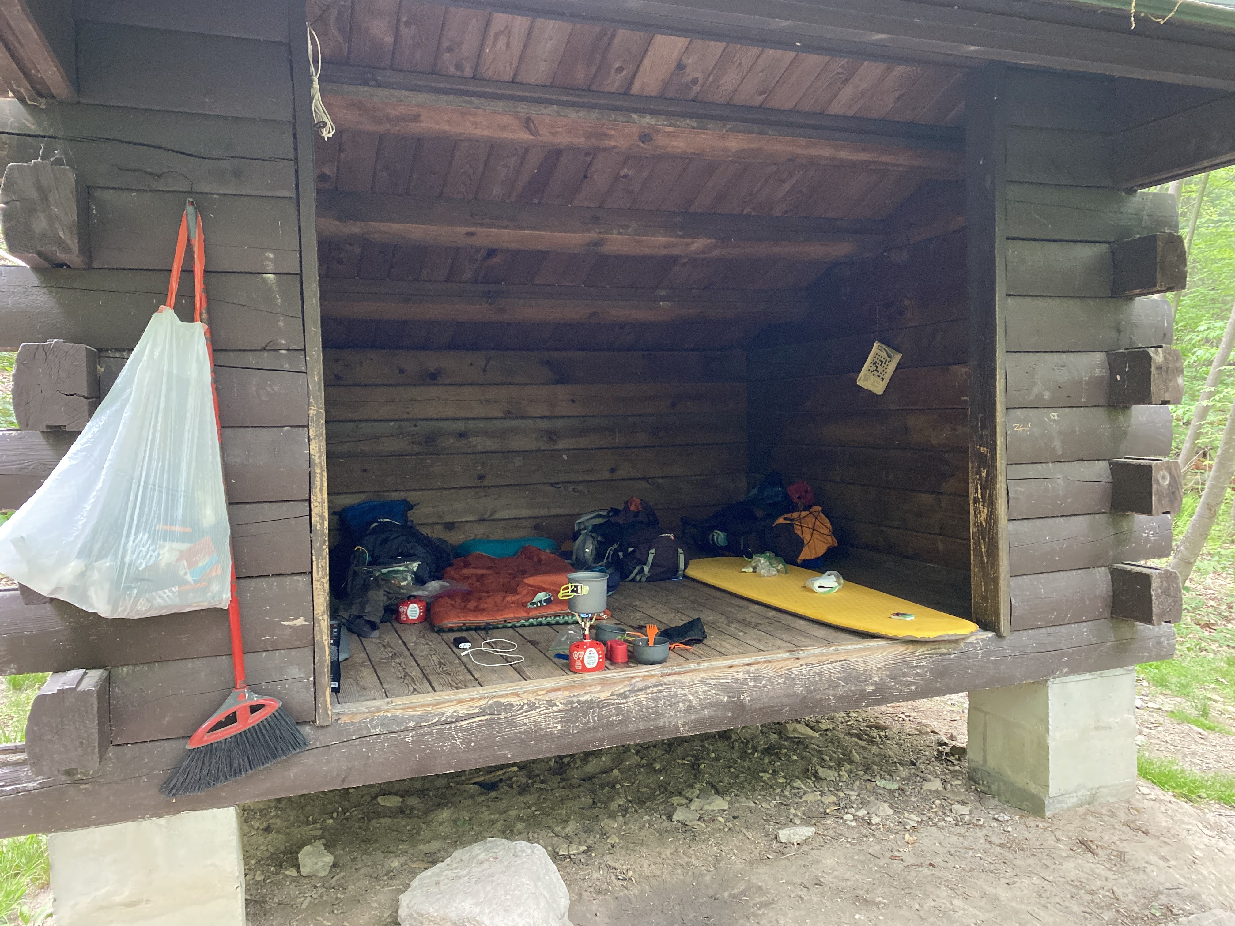
Quarry Gap Shelter was immaculate and well maintained. Of all the shelters we encountered during the weekend, this was the most scenic and quaint. The spring was also nicely kept and picturesque. One might confuse an overnight stay here as "glamping". It felt really good to sit down at the shelter when we arrived.
We were able to secure a picnic table at the shelter and made our lunch. Again the boys enjoyed picking and preparing their meal while I made my first attempt to replenish our water supplies. Dad lent me his Katadyn pump water filter (similar to this one) which worked great to fill our bottles and bladders. I also tested out an integrated filter straw from Epic Water Filters that fits in a Nalgene bottle. This was a really convenient option to fill and go. The only downside was that it only allowed you to drink about 18 ounces out of the 32 ounce bottle due to the filter vents sucking air into the straw. This would force anyone to have to carry two bottles or have a regular water source to fill up. In the heat, 18 ounces for an adult only lasts a couple of miles. Another lesson learned on this trip was that bladders are not the most convenient way to carry water as you need two people to filter the water and fill the bladder. If I was out there on a solo hike, I would have trouble refilling the bladder regularly. Luke carried two 32 ounce Nalgene bottles and that seemed to work fairly well for him and it would be a good solution if you have a way to carry them easily.
Here is the Relive video of this segment:
After lunch and refilling our water supply, we continued our hike towards Caledonia State Park and eventually Rocky Mountain Shelter. The trail leading from the shelter was really nice and flat including more Rhododendron tunnels, pine tree lined trail, and a steady descent all the way to Caledonia State Park. What we didn't anticipate was the pounding on our feet making the descent, the rising temperatures, and the toll it would take. When we reached Caledonia, we needed a good break after only two miles. That is exactly what we did. We found a nice picnic bench area, took off our shoes and socks, raised our feet and relaxed for a good 45 minutes. After the break and on our way out, we snapped this picture while we crossed the bridge over Conococheague Creek and then made our way across Route 30.
The rest break worked but we knew we had a tough hill to climb ahead of us. You can guess by the name of the shelter, that the next segment was going to be challenging. Rocky Mountain Shelter is nestled into a peak of 1700' of boulder formations. This was slow, technical, and tiring climbing for all of us. We traveled very slowly, rested frequently, and just kept putting one foot in front of the other while marveling at the rock formations. Andrew and I reminisced about our climb up Camelback Mountain in Phoenix a few years ago. This was one of the only sections that we saw very few people hiking in either direction. I think crossing Route 30 from Caledonia kept people from going this way, not to mention the terrain.
It was a pleasant site to see the sign to the connecting trail to Rocky Mountain Shelter. However, that was quickly flipped on its head when we realized we would have to hike back down the mountain a quarter mile to the shelter!
When we arrived to the shelter, we learned there was a scout troop taking up most of the camping areas and one of the shelters was already occupied. We were also low on water and needed to refill. The spring was located another quarter mile down the mountain and we would have to hike back up. We made a mistake at this point and actually carried our packs all the way down to the spring, rather than leaving them in the unoccupied shelter to reserve our space and lighten our load. In my worry that we would not find a place to set up camp, I told the boys that we would regroup at the spring and decide what to do from there. Andrew suggested we try hiking to the next shelter which we did contemplate. I was actually hoping to walk along the road located at the spring to find an easy way to potentially hike to the next shelter at Tumbling Run. However, that plan quickly dissipated when I looked at the map and saw it was another 6.5 miles away! Based on how bad our feet felt, there was no way, we were beat.
After refilling all our water supplies, we headed back up to the shelter. With the short break at the spring, we felt much better and the hike back up felt shorter than it felt going down. Fortunately for us, the shelter was still unoccupied and we found our home for the night.
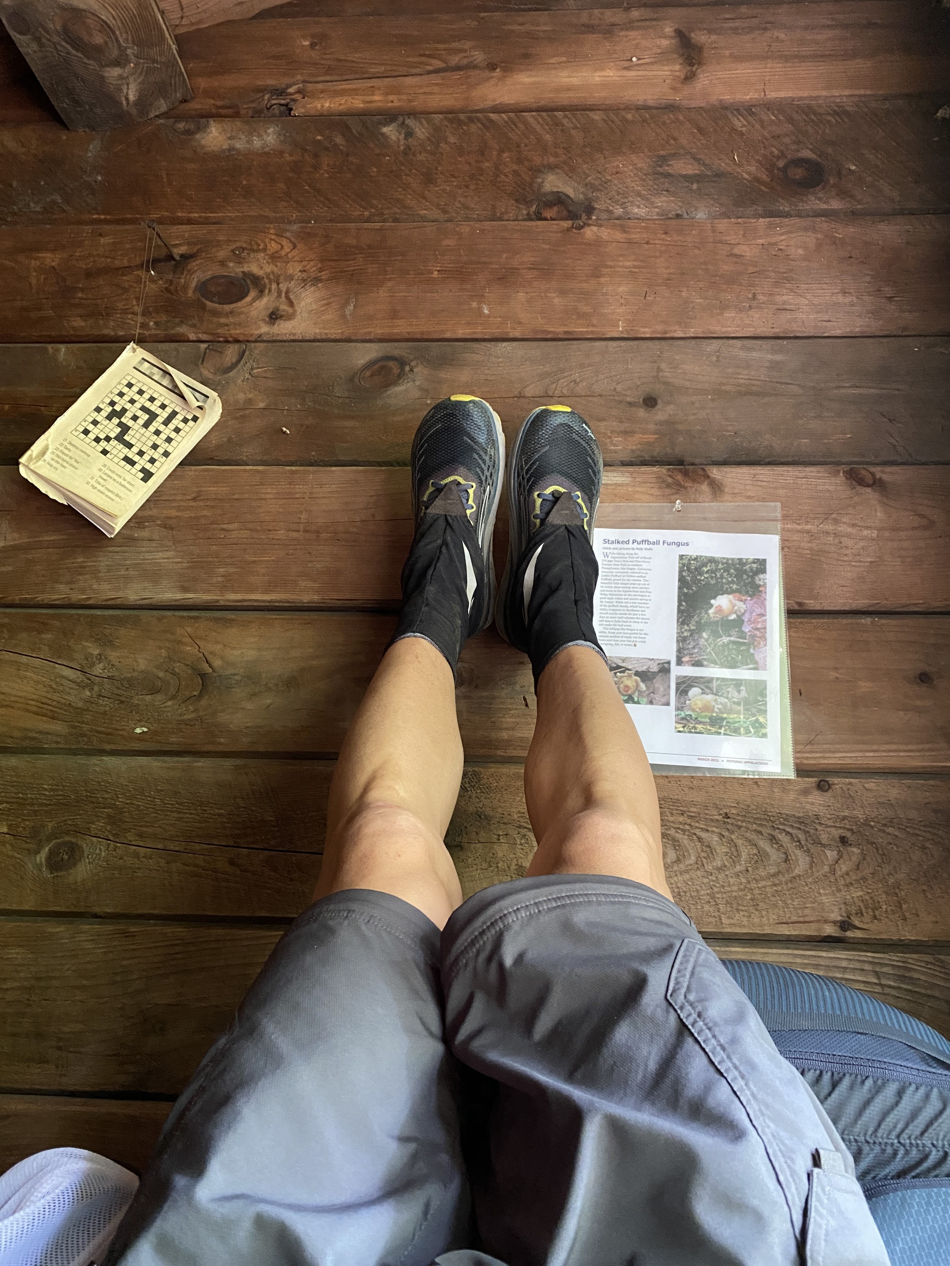
We settled down a little bit after 4 PM and stuck our legs up on the shelter to relax. I taught the boys about the benefit of elevating your feet and they learned for themselves how great it feels on the back and legs! I knew the boys were feeling better because their chatter turned to food again and they began making their dinner. I was not really hungry so I waited and continued to rest my feet.
Having a shelter was really nice because we did not have to make camp at all. This was a huge savings of effort for the afternoon when we arrived and for Sunday morning when we wanted to get going again. The shelter fit us very comfortably and we actually offered to share it with a group of three other hikers that came through later that evening. They elected to hike to the bottom and squeezed in among the scout troop. We also had a few critter friends in the shelter. We had a very large spider that we "swept" out of the ceiling. After looking it up, it was a very large dark swimming spider.
After eating, Luke and Andrew caught a second wind and wondered if we should try to hike to the next shelter again. I knew that would totally bury us and convinced them that the additional recovery would help us for the fifteen miles ahead of us on Sunday. They settled down and made a small fire in front of the shelter to occupy themselves while I finally made my dinner.
Shortly thereafter, we laid down and tried to fall asleep. It took a bit of time, but we were soon asleep before the sun went down. While we were sleeping in the middle of the night, a small mouse began making a mess of a roll of toilet paper. I am not sure whether the mouse was eating the paper or just taking pieces of it to make a nest somewhere. I ended up chasing it off with the light of my head lamp. Otherwise our food and trash were safely stowed away in a bear box down the hill from the shelter.
Here is the Relive video of this final segment on Saturday:
Like Saturday morning, we were awake as the sun rose around 6 AM. The boys went straight into breakfast mode and we were packed up ready to go around 7:15. We had to make one more trip to the spring down the hill (this time leaving our packs behind) and then we were off for the final fifteen miles at 7:44 AM.
The final day of hiking was going to be our longest and most difficult. It included multiple steep climbs, large descents, and tough terrain. I would be lying if I did not admit I was a little worried we might end early based on our performance on Saturday. I suggested that we take frequent five minute breaks and catch our breath regularly on the climbs. Every time I asked the boys if they were "ok", they said, "yes" and continued on. I was ready to throw in the towel at the first sign they were finished. To their credit, they stuck it out and just kept going.
We enjoyed a quick break at Tumbling Run Shelters which had a nice spring to fill up and some cool shade. We continued down the descent into the Old Forge Picnic Area in time for lunch. Antietam Creek was wide and swift moving. We took our shoes and socks off and soaked our feet for several minutes. This was a wonderful relief and rejuvenated our spirits! Again, the boys ate like kings and were high on their horse again to get going.
Before venturing off, we looked at the map and decided to break up the last few elements to give us small goals to count down to the finish. We decided to do it by the number of climbs left, which was four. The first was up to Deer Lick Run Shelters and then a small one at Baily Spring. Just past Old Route 16 would be our biggest test of the trip. Then the last one was a short punchy climb up to Penn Mar just after crossing Red Run Falls Creek. This was a really useful way to stay focused and help the boys count down to the end.
We arrived at Deer Lick Run Shelters around 2:00 PM and with more than four miles to go, I knew we were not going to make our 4 PM meet up time. I texted my wife Tammy, to let her know that we would be running late. I made another mistake at this shelter in my effort to refill our water. As we approached the shelter we crossed Deer Lick Creek which was a fast moving creek and sufficient to fill our reserves. As we laid our packs down a "sectional" hiker came up from the South. She asked about the creek and whether it looked safe, which I obliged. However, I was stubborn and wanted to find the spring head rather than following my own advice. I also did not consult my guide book and just set on the trail to the spring following the blue blazes. Low and behold it was more than a quarter mile away and a royal pain to get to! This did not help at all to keep us on track, but it did give the boys a much needed long break. Despite my frustration, in hindsight this turned out to be a blessing as the road ahead was still challenging.
Shortly after leaving Deer Lick Run Shelters we encountered another wildlife friend, a very large black rat snake! I must have been day dreaming because I nearly stepped on it lying in the middle of the trail.
We trudged along the trail and made it over the second small climb past Bailey Spring and approached the largest of the climbs in this last section. Red Run was a river running along Old Route 16 and we refilled our water supplies again. We rested for a good bit and started our way up. Ahead of us was a 500' climb over about a mile... it was steep. We stopped several times to catch our breath and just kept chipping away at it. There wasn't much talking so I knew we were all suffering. Andrew had a sore back, Luke's hips were rubbed raw from his pack, and my feet were in agony. We nearly reached the top and I decided to pull an audible and breakout some caffeinated energy gels and give them to the boys. When I packed them, I decided it was only if we were feeling rough and if I felt we needed them. This was definitely the time. The boys excitedly tore into them and off we went. It wasn't even five minutes later when Andrew started talking about Star Wars theories... at that point I knew we were going to finish this thing! From here on out, the last thing on my mind was taking pictures along the way... we were focusing on the effort to finish.
After finally summitting, it was an immediate steep descent into a gorge carved out by Red Run Falls Creek which was absolutely beautiful. The trail was right on the edge of the river and it was a little unnerving, but the view was terrific. We crossed the bridge to the other side of the river and prepared to climb out of the gorge towards Penn Mar. This turned out to be a real challenge as it was really steep! But the boys and I knew we were close to the end and just kept chugging along. We reached the flat railroad bed at the top and knew we were nearly finished!
We made our way to the Mason-Dixon line and stopped for some pictures. At that moment, I was feeling a bit disappointed that the boys did not get to meet or see a thru-hiker. Just as I was thinking that, a gentlemen approached after we took our picture at the sign and I saw him pull his phone out to take a selfie at the sign. I asked him if he wanted me to take his picture and he obliged. He then said, "Another state down." Right then I knew he was a thru-hiker! He started his journey from Springer Mountain, Georgia on March 8th and here he was at the Mason-Dixon line at the same time as us, just 33 miles short of his halfway point on the trail. The only regret I had in that moment was I forgot to ask him what his trail name was! Anyhow, the boys got to see someone with the determination and courage to take on such a task. For that I am grateful.
Along the way to the park, I asked the boys what their favorite part was, and they both said, "the food!" Geesh, what a perspective! Andrew also said he would only do another trip if the trail was flat. I am guessing after some time, he will change his mind. Something also tells me that in five or ten years from now they will remember this trip for a whole lot more reasons.
Final Relive video for our Sunday hike:
Overall Statistics for the Trip:
Total distance traveled = 35.23 miles
Total elevation climbed = 5,489'
Total Moving Time = 14 hour 13 minutes
Average Moving Pace = 24.3 minutes / mile
Total Elapsed Time Hiking = 19 hours 17 minutes
Overall Pace = 32.4 minutes / mile
A big thank you to everyone who supported our adventure including Pop Pop, Grama, Grampa, and especially the mothers, Tammy and Heidi. You two were good sports letting us chase adventure!