The inspiration behind our Appalachian Trail adventure started back in March, 2021. After completing a short backpacking trip with his Boy Scout troop, Andrew really got the bug for backpacking. He said his favorite thing about the backpacking trip was the adventure of carrying everything you need on your back and surviving in the woods. In a way, backpacking helped him to experience the fantasy world he enjoys playing on the Nintendo Switch in games like Minecraft and Legend of Zelda. I am not sure to be happy or sad about this fact, but at least he has a desire to experience adventure in reality.
Shortly after the trip, Andrew asked if we could plan another trip and ask his cousin Luke to go along. So, the idea was born. To continue inspiring him, I bought a four foot tall map of the entire Appalachian Trail and began marking off areas of the trail that we have hiked. We had a nice little gap between his scout trip and the Maryland / Pennsylvania Line, therefore we decided that would be the segment we would complete to tie the two together. Andrew did his own investigating of trail information by calling the Appalachian Trail Museum in Pine Grove, PA.
For final planning, I utilized several resources. The most informative was The Appalachian Trail Guide - Pennsylvania - Tenth Edition. This book breaks down every section of the trail into small segments and gives you information on the history, spring locations, topography, and other landmarks. We also utilized the Appalachian Trail Maps compiled and published by the Potomac Appalachian Trail Club. These are very detailed maps showing topography, profiles, and water sources. You will see some scans of the profiles further down in this post. Lastly, the interactive trail map provided by the Appalachian Trail Conservancy was a great resource to zoom right onto the trail using their GIS map which is the most accurate. There are multiple layers to the map including shelters and parking areas. In some cases, pictures of these items are embedded in the layer.
Below is a map from the GIS map of the segment we planned to complete. We initially had two itineraries, one would be leaving early Saturday morning and completing late Sunday evening. The other would be leaving Friday late afternoon and finishing Sunday late afternoon. Fortunately, all worked out that we were able to leave Friday afternoon. In hindsight, cramming the 35 miles in between Saturday and Sunday would have been a real challenge. The rest of this little story would illustrate why. Otherwise, we also planned a bail-out point on Sunday in case the last day of trekking proved to be to much.

Preparing for the trip is part of the adventure! Developing a packing list, figuring out the nutrition and meals you want, planning the rest stops, managing water, and identifying where we want to set up camp for the night are all part of the fun! With five days to go, the weather forecast looked promising, temperatures would range from the mid 60s at night with highs in the 80s. This was a nice change in the weather pattern because it meant we did not have to pack clothes for cooler temperatures and lightened our loads. Below is the packing list the we used. I packed a few extra provisions including a first aid kit, water filtration pump, additional snacks, and extra meal packs.

The day to begin our trail adventure finally arrived on Friday, May 21st. My dad (Pop Pop) was a sporting gentlemen and drove down from his home in Pennsylvania to our house in Maryland to drive Andrew and me to the starting point at Michaux Road at the border of the Pine Grove State Park and Michaux State Forest. My wife's parents (Grama and Grampa) drove Luke from their home in Pennsylvania. Overall, we both had about an hour and a half drive from our homes to the starting point.
We met at 4:30 PM at the small emergency vehicle parking lot at Michaux Road to prepare to begin. Luck would have it that a Pennsylvania DNR officer pulled up right as we were ready to begin. He was very nice, gave us a few tips, and reassured the grand parents that we would be just fine. At 4:46 PM, we began the first leg of our trip.

Our first segment of the trip was a little over seven miles from Michaux Road to Birch Run Shelter. While planning the trip, I referenced the GPS files from our hiking with the scout troop to estimate what our paces might be for this trip. Overall, I planned each segment based on 31 minutes / mile which would include any rest time and I estimated that our planned moving time would be about 22 minutes / mile which was 2.7 miles per hour. At these rates, I estimated we would reach the Birch Run Shelter around 8:00 PM; this would leave just enough daylight to set up camp.
Shortly after starting on the trail, we reached the half-way point of the entire AT. We briefly stopped to take a picture and sign the log book. This was my first opportunity to explain the idea of a "thru-hike" to the boys. I was very curious at the end of two and a half days of hiking what they boys would think about doing this for five straight months! I'll save those thoughts for last.

Shortly after passing the halfway point, we passed Toms Run Shelter area where Andrew and I camped with his boy scout troop. It looked quite different since all the foliage had bloomed and the forest was green. We were impressed by the number of tents we saw and Andrew checked on the rock dam he built in Toms Run with some friends in the stream nearby, of which I was not aware. This was not a good example of "leave no trace" principles. With everything in full growth mode, this shelter area is indeed a great spot and I would recommend it to anyone. We did not linger long though and continued on our way.
After Toms Run, we began our first steady and reasonable climb on the trail. This portion of the trail was lined with pine and deciduous trees. The trail was tame with some rocks, but not at all challenging compared to the later portions of the trail we encountered. The climb started around 1,300' and continued to just above 2,000' at Shippensberg Road and covered approximately 4.2 miles overall. From there, we had a nice steady decline of about a mile to Birch Run Shelter.

I enjoyed listening to the boys banter about as we made our way down the trail. From school to scouts, they covered a ton of different topics catching up on their lives apart. The most entertaining discussion though was about food. For over four miles, the boys spoke nonstop about food! Food at scouts, food at school, food at home, what kinds of food do you like, etc... it went on and on! I was chuckling inside the entire time. I asked several times if they were hungry during this discussion and they both said, "no." This ended up being a common theme the entire trip. They would discuss what meal they wanted to have at the next opportunity. At home after the trip, I asked Andrew what his favorite part of the trip was and he said, "cooking our meals." I guess making your own meals coupled with playing with fire is as exciting as it used to be for me as a kid!
We finally reached the bottom of the decent and crossed over Birch Run and entered the camping area. Being that we arrived just before 8 PM, most of the prime camping spots and the shelter were already occupied. We walked around a bit and went up a small hill to find a clearing and fire ring. The ring had several nice sitting logs around it and served perfectly as our little private camping area. The boy's scout training took over and without asking they began setting up their tents! I am amazed at how well scouts has prepared them for things like this. I also believe their excitement to cook their meal was urging them to get it finished quickly.

Below is a Relive video of our first segment:
Why stop now, let's talk more about food! To make things simple for the boys (and ultimately me), I elected to purchase a variety of Peak ReFuel freeze-dried meals. These were packed with protein and a great amount of calories for the cost. One pack was two servings so generally the boys split one and I either ate one full pack or shared some with the boys. The boys really enjoyed picking from the variety of meals and they made sure they tried every flavor. They loved every one they tried and it did a great job of keeping us nourished. Along the trail, we had a whole host of different snacks including Cliff Bars, Honey Stinger Waffles, peanut butter and jelly, mixed nuts, and beef sticks. Ultimately, the boys were well stocked with snacks. However, I was short by the end of the trip and wished I packed a little more for the trails.

Shortly after we finished eating, we packed up our bear bag and hung it on the nearby pole. The boys were ready for bed and we retired for the night. Unfortunately, we really did not sleep well due to the "wonderful" hooting of a pair of Eastern Screech Owls. These two communicated all night long without rest. I imagined them saying to us over and over again, "Welcome to our forest, you can not sleep!" Ba humbug!
Saturday morning felt like it would never come due to the hooting owls. However, the boys awoke just before 6 AM as the sun began to rise. Again, their scout training went straight into practice with them cleaning up their tents before starting breakfast. They were very efficient and chatted up a storm about what they were going to eat... remember, it is hard for twelve year old boys to whisper... they need to add that to the Scout manual! They dug straight into the strawberry granola breakfast package and I ate the breakfast skillet package. Both meals were really good and we felt ready to go. I was the slow one getting my pack together (I was never a boy scout) and held the boys up from starting... we hit the trail at 7:44 AM.
Heading towards Quarry Gap Shelter, the trail remained fairly tame and had some nice areas of soft pine needle covering. We made really good progress with a few breaks and felt really good overall. The boys were cruising and definitely in full enjoyment mode. We looked for a place to take a break and came upon a fallen tree which looked inviting. However, after looking underneath it looked like a perfect area for snakes to hide, so we moved on. Not fifty yards down the trail, we encountered a timber rattlesnake! Fortunately as I approached, I saw it just in time and backed away as it partially slithered off the trail next to a tree. Unfortunately, it did not continue all the way and left us standing there waiting. I decided to toss a few small twigs at it's tail to see if it would move off. Low and behold, it did not like that and coiled up into a defensive position with its head reared and ready to strike! Now we were really stumped. As we discussed what to do, several hikers came from the south toward us and I stopped them to admire our friendly fellow. We all stood there looking at it trying to decide if it was worth running by it. After a few minutes, that is exactly what we did. We each took turns running by our snake friend and moving on.

We continued into the late morning and the temperature was climbing along with the trail elevation. The segment from Birch Run to Quarry Gap Shelter rises and falls several times and concludes with a rather steep descent. This was the first time the boys experienced how trekking downhill can be equally or more taxing on your legs than going uphill.

On approach to the shelter, the trail was surrounded by Rhododendron bushes which simulated walking through tunnels of foliage, it was one of my favorite parts of the trail.
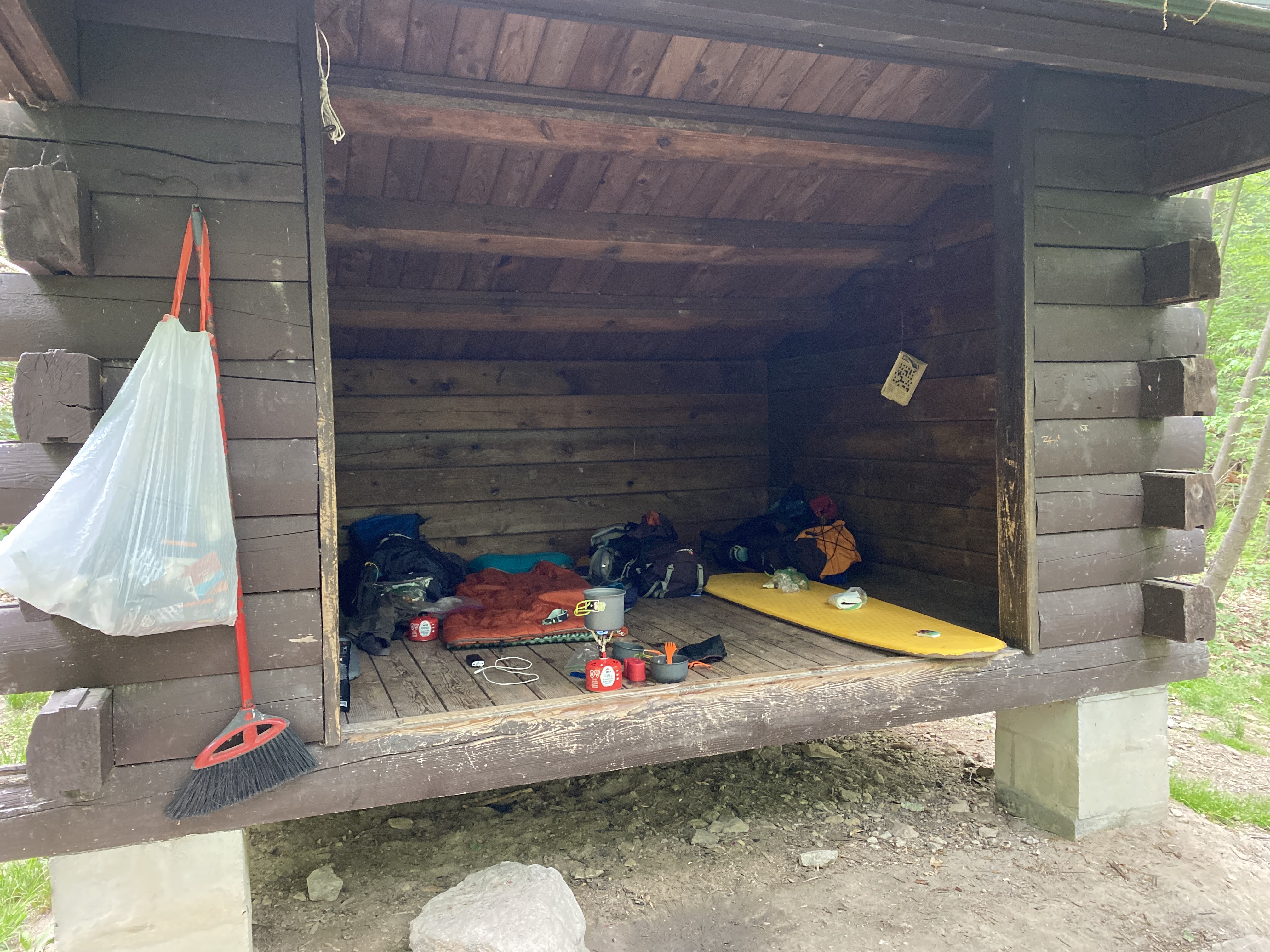
Quarry Gap Shelter was immaculate and well maintained. Of all the shelters we encountered during the weekend, this was the most scenic and quaint. The spring was also nicely kept and picturesque. One might confuse an overnight stay here as "glamping". It felt really good to sit down at the shelter when we arrived.

We were able to secure a picnic table at the shelter and made our lunch. Again the boys enjoyed picking and preparing their meal while I made my first attempt to replenish our water supplies. Dad lent me his Katadyn pump water filter (similar to this one) which worked great to fill our bottles and bladders. I also tested out an integrated filter straw from Epic Water Filters that fits in a Nalgene bottle. This was a really convenient option to fill and go. The only downside was that it only allowed you to drink about 18 ounces out of the 32 ounce bottle due to the filter vents sucking air into the straw. This would force anyone to have to carry two bottles or have a regular water source to fill up. In the heat, 18 ounces for an adult only lasts a couple of miles. Another lesson learned on this trip was that bladders are not the most convenient way to carry water as you need two people to filter the water and fill the bladder. If I was out there on a solo hike, I would have trouble refilling the bladder regularly. Luke carried two 32 ounce Nalgene bottles and that seemed to work fairly well for him and it would be a good solution if you have a way to carry them easily.
Here is the Relive video of this segment:


The rest break worked but we knew we had a tough hill to climb ahead of us. You can guess by the name of the shelter, that the next segment was going to be challenging. Rocky Mountain Shelter is nestled into a peak of 1700' of boulder formations. This was slow, technical, and tiring climbing for all of us. We traveled very slowly, rested frequently, and just kept putting one foot in front of the other while marveling at the rock formations. Andrew and I reminisced about our climb up Camelback Mountain in Phoenix a few years ago. This was one of the only sections that we saw very few people hiking in either direction. I think crossing Route 30 from Caledonia kept people from going this way, not to mention the terrain.


After refilling all our water supplies, we headed back up to the shelter. With the short break at the spring, we felt much better and the hike back up felt shorter than it felt going down. Fortunately for us, the shelter was still unoccupied and we found our home for the night.
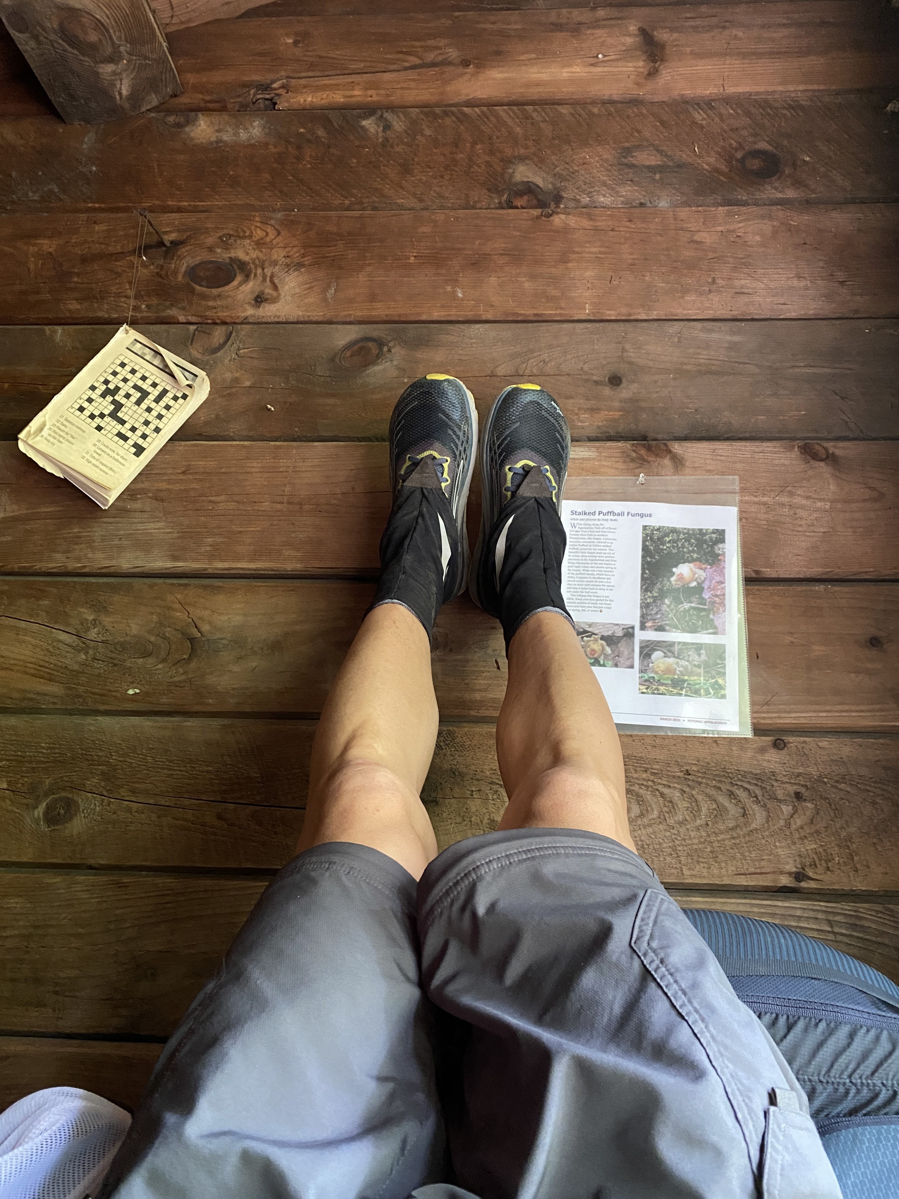
We settled down a little bit after 4 PM and stuck our legs up on the shelter to relax. I taught the boys about the benefit of elevating your feet and they learned for themselves how great it feels on the back and legs! I knew the boys were feeling better because their chatter turned to food again and they began making their dinner. I was not really hungry so I waited and continued to rest my feet.


Having a shelter was really nice because we did not have to make camp at all. This was a huge savings of effort for the afternoon when we arrived and for Sunday morning when we wanted to get going again. The shelter fit us very comfortably and we actually offered to share it with a group of three other hikers that came through later that evening. They elected to hike to the bottom and squeezed in among the scout troop. We also had a few critter friends in the shelter. We had a very large spider that we "swept" out of the ceiling. After looking it up, it was a very large dark swimming spider.

After eating, Luke and Andrew caught a second wind and wondered if we should try to hike to the next shelter again. I knew that would totally bury us and convinced them that the additional recovery would help us for the fifteen miles ahead of us on Sunday. They settled down and made a small fire in front of the shelter to occupy themselves while I finally made my dinner.

Shortly thereafter, we laid down and tried to fall asleep. It took a bit of time, but we were soon asleep before the sun went down. While we were sleeping in the middle of the night, a small mouse began making a mess of a roll of toilet paper. I am not sure whether the mouse was eating the paper or just taking pieces of it to make a nest somewhere. I ended up chasing it off with the light of my head lamp. Otherwise our food and trash were safely stowed away in a bear box down the hill from the shelter.
Here is the Relive video of this final segment on Saturday:
Like Saturday morning, we were awake as the sun rose around 6 AM. The boys went straight into breakfast mode and we were packed up ready to go around 7:15. We had to make one more trip to the spring down the hill (this time leaving our packs behind) and then we were off for the final fifteen miles at 7:44 AM.

The final day of hiking was going to be our longest and most difficult. It included multiple steep climbs, large descents, and tough terrain. I would be lying if I did not admit I was a little worried we might end early based on our performance on Saturday. I suggested that we take frequent five minute breaks and catch our breath regularly on the climbs. Every time I asked the boys if they were "ok", they said, "yes" and continued on. I was ready to throw in the towel at the first sign they were finished. To their credit, they stuck it out and just kept going.
We enjoyed a quick break at Tumbling Run Shelters which had a nice spring to fill up and some cool shade. We continued down the descent into the Old Forge Picnic Area in time for lunch. Antietam Creek was wide and swift moving. We took our shoes and socks off and soaked our feet for several minutes. This was a wonderful relief and rejuvenated our spirits! Again, the boys ate like kings and were high on their horse again to get going.


Before venturing off, we looked at the map and decided to break up the last few elements to give us small goals to count down to the finish. We decided to do it by the number of climbs left, which was four. The first was up to Deer Lick Run Shelters and then a small one at Baily Spring. Just past Old Route 16 would be our biggest test of the trip. Then the last one was a short punchy climb up to Penn Mar just after crossing Red Run Falls Creek. This was a really useful way to stay focused and help the boys count down to the end.
We arrived at Deer Lick Run Shelters around 2:00 PM and with more than four miles to go, I knew we were not going to make our 4 PM meet up time. I texted my wife Tammy, to let her know that we would be running late. I made another mistake at this shelter in my effort to refill our water. As we approached the shelter we crossed Deer Lick Creek which was a fast moving creek and sufficient to fill our reserves. As we laid our packs down a "sectional" hiker came up from the South. She asked about the creek and whether it looked safe, which I obliged. However, I was stubborn and wanted to find the spring head rather than following my own advice. I also did not consult my guide book and just set on the trail to the spring following the blue blazes. Low and behold it was more than a quarter mile away and a royal pain to get to! This did not help at all to keep us on track, but it did give the boys a much needed long break. Despite my frustration, in hindsight this turned out to be a blessing as the road ahead was still challenging.
Shortly after leaving Deer Lick Run Shelters we encountered another wildlife friend, a very large black rat snake! I must have been day dreaming because I nearly stepped on it lying in the middle of the trail.

We trudged along the trail and made it over the second small climb past Bailey Spring and approached the largest of the climbs in this last section. Red Run was a river running along Old Route 16 and we refilled our water supplies again. We rested for a good bit and started our way up. Ahead of us was a 500' climb over about a mile... it was steep. We stopped several times to catch our breath and just kept chipping away at it. There wasn't much talking so I knew we were all suffering. Andrew had a sore back, Luke's hips were rubbed raw from his pack, and my feet were in agony. We nearly reached the top and I decided to pull an audible and breakout some caffeinated energy gels and give them to the boys. When I packed them, I decided it was only if we were feeling rough and if I felt we needed them. This was definitely the time. The boys excitedly tore into them and off we went. It wasn't even five minutes later when Andrew started talking about Star Wars theories... at that point I knew we were going to finish this thing! From here on out, the last thing on my mind was taking pictures along the way... we were focusing on the effort to finish.
After finally summitting, it was an immediate steep descent into a gorge carved out by Red Run Falls Creek which was absolutely beautiful. The trail was right on the edge of the river and it was a little unnerving, but the view was terrific. We crossed the bridge to the other side of the river and prepared to climb out of the gorge towards Penn Mar. This turned out to be a real challenge as it was really steep! But the boys and I knew we were close to the end and just kept chugging along. We reached the flat railroad bed at the top and knew we were nearly finished!
We made our way to the Mason-Dixon line and stopped for some pictures. At that moment, I was feeling a bit disappointed that the boys did not get to meet or see a thru-hiker. Just as I was thinking that, a gentlemen approached after we took our picture at the sign and I saw him pull his phone out to take a selfie at the sign. I asked him if he wanted me to take his picture and he obliged. He then said, "Another state down." Right then I knew he was a thru-hiker! He started his journey from Springer Mountain, Georgia on March 8th and here he was at the Mason-Dixon line at the same time as us, just 33 miles short of his halfway point on the trail. The only regret I had in that moment was I forgot to ask him what his trail name was! Anyhow, the boys got to see someone with the determination and courage to take on such a task. For that I am grateful.

Along the way to the park, I asked the boys what their favorite part was, and they both said, "the food!" Geesh, what a perspective! Andrew also said he would only do another trip if the trail was flat. I am guessing after some time, he will change his mind. Something also tells me that in five or ten years from now they will remember this trip for a whole lot more reasons.


Final Relive video for our Sunday hike:
Overall Statistics for the Trip:
Total distance traveled = 35.23 miles
Total elevation climbed = 5,489'
Total Moving Time = 14 hour 13 minutes
Average Moving Pace = 24.3 minutes / mile
Total Elapsed Time Hiking = 19 hours 17 minutes
Overall Pace = 32.4 minutes / mile
A big thank you to everyone who supported our adventure including Pop Pop, Grama, Grampa, and especially the mothers, Tammy and Heidi. You two were good sports letting us chase adventure!